Showing posts with label oldest. Show all posts

Saturday, February 14, 2026

A NEW CANDIDATE FOR THE OLDEST ROCK ART - A 67,000+ YEAR OLD HANDPRINT:


Researcher Maxime Aubert  in a limestone cave called Liang Metanduno on Muna. Photograph Ahdi Agus Oktaviana, 21 January 2026.

Almost a year ago I published a column on RockArtBlog on what was claimed to be the oldest rock art discovered so far, a 66,000+ year old hand print in Maltrivieso Cave in Spain (Faris 2025). Now, a new candidate has emerged from a cave on the Indonesian island of Muna, a handprint dated at 67,800+ years of age.

The islands in the Indonesian archipelago were on the transit route for the early humans who ended up in Australia. Some of these people would have settled locally in their tropical paradise, and this was very early indeed in the chronicles of human migration. “In an Indonesian cave system known for its prehistoric art, the oldest cave art yet found was hiding in plain sight. In a cave full of paintings that were well studied over the years, a faint hand stencil on the ceiling had been overlooked. – A nearby stencil dated to about 60,900 years ago.” (Callaway 2026)

Overlooked because of its location and being faded. It will be very interesting to see what future results of these studies will produce. There may be much more to learn there.

The faint handprint between two other images. Image from Griffith University.

Having found this overlooked handprint, their next step was to date it. “The oldest minimum-age constraint we obtained is for a hand stencil (sample LMET2) from Liang Metanduno in Muna Island. This motif is partly covered by ancient coralloid speleothems. This stencil is in a poor state of preservation, comprising only a 14 × 10 cm patch of faded pigment bearing a portion of the fingers and the adjoining palm area. The tip of one finger appears to have been artificially narrowed, either through the additional application of pigment or by moving the hand during pigment application, a distinct type of hand stencil art thus far identified only in Sulawesi. Dating results show that this stencil was produced at least 67.8  thousand years ago (ka) (71.6 ± 3.8 ka).” (Oktavian et al. 2026) This dating was apparently made with uranium/thorium dating of rock deposited over the surface of the handprint. This means that the higher figure of 71.6 thousand years could, in fact, be close to the accurate date.

Close-up of the handprint. Image from Griffith University.

In ages of lowered sea levels the Indonesian archipelago could have been transited on foot, and at times of higher sea level early rafts or boats would suffice for population movement. “It’s not yet clear whose hands made the prints. They could be from an ancient human group called Denisomans who lived in the area and may have interacted with our Homo sapiens ancestors before eventually going extinct. Or they may belong to modern humans venturing away from Africa, who could have wandered through the Middle East and Australia around this time. Fine details on the cave art, including the intentionally modified fingertips, point to a human hand.” (Ramakrishnan 2026) While we are pretty sure that early humans were here because of their early arrival in Australia, we cannot know for certain that Homo sapiens made these prints. As Ramakrishnan states it is possible that Denisovans also could have been in that area although there is not yet any corroborating data for that. We must remember that “absence of evidence is not evidence of absence” (although this quote is usually attributed to Carl Sagan its first uses can be traced back to the 1890s).

Additional examples of handprints with narrowed fingers. Image by Maxime Aubert.

This narrowing of the fingertip is very interesting. “Consistent with a style that has, so far, only been found on Sulawesi, the hand is depicted with pointy, clawlike fingers. Researchers believe the style might serve to emphasize the close connection between humans and animals, which is “something we already seem to see in the very early painted art of Sulawesi, with at least one instance of a scene portraying figures that we interpret as representations of part-human, part-animal beings,’ said study co-author Adam Brumm of Griffith University in a statement.” (Callaway 2026) I am assuming that this part-human, part-animal interpretation is seeing the narrowed fingertips as portrayals of hands with claws. This is something that I have to take with a grain of salt. While therianthropic figures mixing human and animal traits are common in rock art the world over a picture of a handprint with narrow fingers does not strike me as related.


REFERENCES:

Callaway, K.R., 2026, Oldest cave art ever found discovered in Indonesia, www.scientificamerican.com. Accessed online 21 January 2026.

Faris, Peter, 2025, A newer candidate for the oldest rock art – a 66,000+ year old hand print, 18 January 2025, RockArtBlog, https://www.blogger.com/blog/post/edit/7760124847746733855/3761715241354171606

Oktavian ,Adhi Agus et al., 2026, Rock art from at least 67,800 years ago in Sulawesi, Nature online, https://doi.org/10.1038/s41586-025-09968-y.

Ramakrishnan, Adithi, 2026, Indonesian handprints are the oldest cave art found yet, 21 January 2026, Associated Press. Accessed online 2 February 2026.

Saturday, December 13, 2025

ASSEMBLED FRAGMENTS OF THE WORLD’S OLDEST DATED RUNESTONE:

Assembled Svingerud rune stone with drawings. Image from Solheim et al., 2025.

Fragments of sandstone recovered from several graves in Svingerud, Norway have been reassembled into a single stone with runic inscriptions that have yielded the earliest known date for such an inscription. Various references read so far from the stone are Svingerud and Hole (a small village nearby).

It is believed that the idea of runic writing, of recording their language by making marks on a surface, was inspired by writing from somewhere around the Mediterranean. The shapes of the runes were, however, independently invented, not copied from Mediterranean examples.

“The development of runic writing (the early Germanic alphabetic script) and the practice of inscribing runes on stone are difficult to trace, particularly as rune-stone inscriptions are rarely found in original and/or datable contexts. The discovery of several inscribed sandstone fragments at the grave field at Svingerud, Norway, with associated radiocarbon dates of 50 BC–AD 275, now provide the earliest known context for a runestone. An unusual mixture of runes and other markings are revealed as the fragments are reconstructed into a single standing stone, suggesting multiple episodes of inscription and providing insight into early runic writing practices in Iron Age Scandinavia.” (Solheim et al. 2025:422) What is so fascinating is that it was broken up and the fragments distributed like this with at least one found in a grave.

Runic inscription. Photograph by Alexis Panto KHM.

I think that the context of the discovery suggests that runic writing and the stone upon which it had been inscribed, must have been considered especially significant to the people of that time and place.

“In a flat grave beneath one of the grave mounds,a sandstone fragment with runes from the older futhark was uncovered. Five radiocarbon dates and artifacts included in the burial suggest that the grave dates to the Roman Iron Age, between 50 BC and AD 275. Additional sandstone fragments with runes were discovered in other contexts during the excavations. Detailed examination confirms that the fragments are all from the same original slab while the inscriptions may represent different acts of carving. In this first comprehensive archaeological and runological study of the Svingerud find, we piece together the finds made during different seasons of excavation and drawn from different dating contexts, and assess the multiple inscriptions found on the different fragments. Associated radiocarbon dates indicate that this is the earliest dated rune-stone found so far; runological analysis of the multiple thinly incised markings therefore provides important insights into early runic writing and inscriptional practices on stone.” (Solheim et al. 2025:423) With different carving episodes the purpose of this stone is a real conundrum. Not only that, but then the stone was broken up and distributed around – why?

Map of Norway showing the general location of the find. Online image, public domain.

A great number of the symbols have been identified, but the researchers do not yet have translations of the meanings of the inscriptions. “The runic fragments from the Svingerud grave field can be dated between 50 BC and AD 275 based on radiocarbon dates from grave A4367, which contained the inscribed fragment Hole 2. This is a rare example of finding several fragments of a rune-stone, with some of the fragments in well-preserved, datable archaeological contexts. The dating frame is relatively wide, but still makes the Hole fragments the earliest known archaeologically dated rune-stone. The early dates and the inscriptional features are new evidence on the use of runes on stone, prompting discussion on the meanings and functions of the fragments and early Scandinavian rune-stones. Particular rune-forms on the dated fragments—such as the multi-pocket ‘b’ and the multitude of zigzag-like marks—underpin the epigraphic importance of the find. The recorded forms may show some early variants of runes, used on stone.” (Solheim et al. 2025:437) The episodes of engraving were apparently far enough apart in time that the forms of some of the runes had changed, leading to the difficulties in translation.

So we have the earliest known rune stone, with inscriptions dating from more than one episode of engraving, which was then broken up and the pieces distributed around the area of a burial site. This brings up so many questions, and provides very few answers, but it is certainly intriguing.

NOTE: Some images in this column were retrieved from the internet with a search for public domain photographs. If any of these images are not intended to be public domain, I apologize, and will happily provide the picture credits if the owner will contact me with them. For further information on these reports you should read the original reports at the sites listed below.

REFERENCES:

Ancientist.com, 2025, Norway’s Oldest Dated Runestone? Svingerud Fragments Reveal a 2,000-Year-Old Writing Tradition, DOI:https://doi.org/10.15184/aqy.2024.225. Accessed online 22 September 2025.

Biornstad, Lasse, 2025, Researchers found more pieces of the world’s oldest runestone – may change the history of runes, 6 February 2025, sciencenorway.no. Accessed online 22 September 2025.

Solheim, Steinar et al., 2025, Inscribed sandstone fragments of Hole, Norway: radiocarbon dates provide insight into rune-stone traditions, Antiquity , Volume 99 , Issue 404 , April 2025 , pp. 422 – 439. Accessed online 6 September 2025.

Thursday, April 10, 2025

HAS THE OLDEST HUMAN STONE CARVING BEEN DISCOVERED IN SPAIN?


Marbella, Spain. Internet photograph, public domain.

The discovery of a piece of stone with intentionally human-made markings on it may provide the oldest human stone carving yet found. Note, I said stone carving. At this time the oldest painted image may be a painted pig-like creature in a cave on the Indonesian island of Sulawesi that dates back to approx. 5.5 ka. (Faris 2024)

“The carvings were found during excavations at the Coto Correa archaeological site, located in the Las Chapas neighborhood of Marbella, Spain. Coto Correa was first identified during the 1950s with the accidental discovery of stone tools that date from the Palaeolithic period, as well as other tools from the Chalcolithic and Late Bronze Age. The oldest stone tools date from between 1,500,000 5o 100,000 BC and confirms the presence of prehistoric settlers living in the Marbella region during the Early to Middle Palaeolithic, a period when modern humans began migrating out of Africa and began to replace other Homo species such as the Neanderthals and Homo Erectus.” (Milligan 2025)

“Until now, the roots of prehistoric rock art have been assumed to trace back to the Upper Paleolithic era, beginning around 50,000 BC. Cave paintings and engravings from that period have been found throughout Europe, frequently in caves and other times on large rocks or cliff faces. The choice of rock art theme suggests a desire to communicate about daily life in some instances, and an interest in conveying more complex ideas about nature, mythology and spiritual interests in others.” (Falde 2025) This is, of course, the result of the Eurocentric bigotry that prevailed during the last (the 20th) century.

View of stone showing incised lines in the center of the photograph. Internet photograph, public domain.

This stone has been tentatively dated to 200,000 years old. “An analysis of finds from ongoing excavations have identified a set of carved markings on a gabbro stone block that could be 200,000 years old, potentially predating the oldest known cave art by 100,000 years.  To confirm this finding, the Department of Culture is conducting a detailed geoarchaeological analysis: ‘The techniques applied for absolute dating consist of quartz analysis of different sediment samples, which will allow for a precise chronology of the samples.’” (Milligan 2025) Once this is accomplished there will be hard data upon which to build further analyses.

A few hypotheses have been put forward for the creation of these marks to date. “It’s possible the markings could have served as a form of early record-keeping, perhaps tracking events, quantities of objects, or notable achievements. Some suggest the markings could function as a form of identification, designating ownership over the stone itself. Alternatively, these carvings may have held symbolic or ritualistic significance, which if true would prove and intriguing glimpse into the cognitive abilities of ancient humans.” (Falde 2025) If, as suggested, the markings are tracking events or notable achievements, they would represent some form of mnemonic aide as they do not seem to present an image of an event or the accomplishment of a notable deed. It seems entirely possible that they are just some form of “kilroy was here”, just a record of presence.

Analysis is ongoing to establish firm dating and to examine it for any other markings. “’In addition, documentation work will be carried out using 3D scanning, which will allow for a high-resolution virtual composite of the set of marks. This will allow the entire surface to be studied in maximum detail, allowing for the identification of working marks and graphic elements,’ added the Department of Culture.” (Milligan 2025) Hopefully this will point to additional marks, more evidence for analysis.

So what do the marks represent? I personally do not see record keeping, tallies, or mnemonic aides. I think I see ‘tagging’. Humans seem to have a subconscious need to alter their environment, and I see no reason why pre-sapiens hominids would not have also possessed that trait. With more data and ongoing studies the team may be able to judge which hominid species had produced the markings, Neanderthal or Homo Erectus.

REFERRENCE:

Falde, Nathan, 2025, Oldest Rock Art: 200,000-Year-Old Carvings Found on Stone in Marbella, Spain, 14 March 2025, https://www.ancient-origins.net. Accessed online 3 April 2025.

Faris, Peter, 2024, A New Candidate for the Oldest Known Artwork, 10 August 2024, RockArtBlog, https://rockartblog.blogspot.com

Milligan, Mark, 2025, Discovery at Las Chapas could be the oldest stone carvings of human origin, 12 March 2025, https://archaeology.org/news/, Accessed online 13 March 2025.

Saturday, March 1, 2025

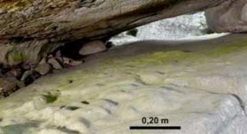
IS A MODIFIED CAVE FLOOR IN FRANCE THE EARLIEST KNOWN MAP?

View out of the Ségognole 3 rock shelter, Fontainbleu, in the Paris Basin, France. Online image, public domain.

Readers of RockArtBlog may remember that I have been a skeptic of many claims of ancient maps in various rock art media. This one, however, might actually be real. An apparent carved stone map has been discovered at Fontainbleu, outside of Paris. “Researchers have unearthed what may be the world’s oldest three-dimensional map, located in the Paris Basin. Found within a quartzitic sandstone megaclast at the Ségognole 3 rock shelter.” (Science News Today 2025)

Geophysicists Medard Thiry of Mines Paris – PSL Centre of Geosciences,  and Anthony Milnes from the Adelaide School of Physics, Chemistry and Earth Sciences noticed signs of carving on the cave floor and, after investigating further recognized two features apparently produced by humans. Thiry and Milnes surveyed water courses in the cave and found a pattern of human manipulation and modification. (Cassella 2025)

Supposed map carved into the floor of the cave. Photograph by Pascal Crapet, Fontainebleau, Courtesy of Médard Thiry.

“Around 20,000 years ago, the prehistoric people who sheltered in this cave carved and smoothed the stone floors to create what looks like a miniature model of the surrounding valley, according to geoscientists Medard Thiry and Anthony Milnes. As water from the outside world trickled through carefully laid-out channels, basins and depressions in the cave, the surface would have come alive with rivers, deltas, ponds, and hills.” (Cassella 2025)

Along with this landscape another set of grooves seem to illustrate a portion of the torso of a female figure with pelvis, groin, thighs and hips.

"Thanks to his extensive research on the origins of Fontainebleau sandstone, Dr. Thiry recognized several fine-scale morphological features that could not have formed naturally, suggesting that they were modified by early humans. 'Our research showed that Paleolithic humans sculpted the sandstone to promote specific flow paths for infiltrating and directing rainwater, which is something that had never been recognized by archaeologists,' Thiry says. 'The fittings probably have a much deeper, mythical meaning, related to water. The two hydraulic installations - - that of the sexual figuration and that of the miniature landscape - - are two the three meters from each other and are sure to relay a profound meaning of conception of life and nature, which will never be accessible to us.'" (Pacillo 2025)

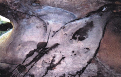
Carved female torso inside the cave opening. Photograph by Médard Thiry.

Rainfall seeping into the cavern through fractures runs across the cave floor where is pools in low points. The largest and most elevated of these pools shows indications of having been enlarged and deepened by humans, and it functions as the source of water for the features. Water from this basin runs further into the cave, splitting into two streams with one running through the carved pelvis where it runs out of the ‘vulva,’ and the other running into the carved map. The hills or mounds in the carved landscape are rounded and some are encircled by deep grooves. (Cassella 2025)

Previously, the oldest known three-dimensional map was a rock slab carved with a local river network and landscape features about 3,000 years ago in the Bronze Age. The Segognole 3 map provides a new view of these prehistoric people's perception of the world around them. (Science News Today) 

These reports certainly seem credible and may, indeed, represent the oldest map in the world. I, however, am more interested in the female representation and the purposeful way the water reportedly interacts with it, providing animation of a biological process. In any case, the two features provide some insight into the cognitive processes of people in that distant age.

NOTE: One or more images in this posting were retrieved from the internet with a search for public domain photographs. If any of these images are not intended to be public domain, I apologize, and will happily provide the picture credits if the owner will contact me with them. For further information on these reports you should read the original reports at the sites listed below.

PRIMARY REFERENCES:

Cassella, Carly, 2025, Earliest Known 3D Map Found in Prehistoric French Cavern, Say Experts, 7 January 2025, https://www.yahoo.com/news/. Accessed online 14 January 2025.

Pacillo, Lara, 2025, World’s oldest 3D map discovered, 13 January 2025, University of Adelaide, https://www.sciencedaily.com. Accessed online 14 January 2025.

Science News Today, 2025, World’s Oldest 3D Map Unearthed in French Cave, 17 January 2025, https://www.sciencenewstoday.org. Accessed online 22 January 2025.

SECONDARY REFERENCE:

Thiry, Médard et al, 2024, Palaeolithic map engraved for staging water flows in a Paris Basin shelter, Oxford Journal of Archaeology. DOI: 10.1111/ojoa.12316.