Saturday, January 30, 2021

UNDERWATER ROCK ART, PART 4 - FAKES:

Supposed mammoth, Traverse Bay, Lake Michigan. Photograph Mike Holley, 2015.

In any detailed examination of a subject there are always bound to be a few surprises and this one is no exception. In my ruminations about underwater rock art, and rock art which is soon to be in danger of becoming underwater rock art, I just did not foresee running into examples of fake rock art underwater. Now I must be the first to admit that not all will agree that the examples I am going to give are indeed fakes, but I believe them to be and will thus treat them accordingly.

Before I get to the point of branding examples as outright fakes, however, I want to revisit the first underwater rock art site I visited in this series - the Lake Michigan underwater mammoth petroglyph in Traverse Bay. Now I have no evidence that it is any kind of forgery or misinterpretation, and it is certainly underwater, I feel the need to confess to a certain amount of skepticism based upon its appearance. I have been unable to find an unretouched photograph, and the original discoverer has not responded to my inquiries so I am limited in factual data.  It just does not look right to me, so I will include it as a possible example of fake underwater rock art.


Noman's Island rune stone, Martha's Vineyard, Massachusetts. Online photograph, Public Domain.

The next example is the so-called “Noman’s Island Rune Stone.” I wrote about this in my column of July 21, 2018. A supposed runic carving on a boulder off of the coast of a small island three miles off of Martha's Vineyard. The oldest known photographs of the rock were taken by its discoverer, Joshua Crane, in 1926. These photos passed to Edward Gray who wrote a book titled “Leif Ericsson, Discoverer of America. (Hickey 2007) It is now almost always submerged in the ocean.

“Gray sent his photos to some experts at Oslo University. What the professors came back with was certainly interesting - and had the potential to throw three centuries of accepted history on its head. Once deciphered the text read, ‘Liif Iriksson, MI.’ (Berke 2015) In this text, the MI is taken to be the Roman Numerals for 1001 (the supposed year of the inscription). This mixing of runes and Latin script was know in Britain after AD 700 (where Anglo-Saxon runes and Latin numerals were sometimes used together). ‘The characters were generally replaced by the Latin alphabet as the cultures that had used the runes underwent Christianisation by approximately 700 AD in central Europe and 1100 AD in northern Europe.’ (Wikipedia) This suggests that it would be contradictory for an authentic Northman’s Viking inscription from the year 1001 to contain a Latin notation, and since none of the records seem to suggest that Leif Ericsson’s expedition included Anglo-Saxons, that would seem to settle it. If one plugs the name Leif Ericson into a modern English to Runic translator, the results come back fairly convincingly like the inscription with slight differences for the different spelling (it actually translated to Liif Iriksson as noted above. This would be close enough to convince me - if the ancient Vikings of a thousand years ago had spelled their words the same way that we do in modern English. Different languages do not always share all of the same sounds and pronunciations. This, in itself, would be enough to make me suspicious of any supposed Runic inscription that translates so handily into English.” (Faris 2018)


Underwater rock art, Venezuela. Photographs Pablo Novoa Alvarez.

My final example of fake rock art underwater showed up on Facebook last August 12, 2020, posted by a Pablo Novoa Alvarez, purporting to show underwater petroglyphs in Venezuela somewhere. No amount of searching on my part has been able to turn up any further information on them. The photographs available, however, are obviously faked up. Without any evidence to the contrary I am including these as my last example of faked underwater rock art.

There are two final points I need to make here. First, anyone who has other examples of phony underwater rock art (or authentic underwater rock art for that matter) can send it to me and I will include it in a future posting on RockArtBlog with complete and proper citation. Second, if anyone has evidence about the examples I have already given and would like to share it I will happily also include that in a future posting on RockArtBlog with complete and proper citation.

NOTE: Some images in this posting were retrieved from the internet with a search for public domain photographs. If any of these images are not intended to be public domain, I apologize, and will happily provide the picture credits if the owner will contact me with them. For further information on these reports you should read the original reports at the sites listed below.

REFERENCES:

Faris, Peter, 2018 Another Suppposed North American Rune Stone, July 21, 2018, RockArtBlog, https://rockartblog.blogspot.com/search/label/runes

Hickey, Jim, 2007, Revisiting Viking Myth on Island, Noman's Expedition Is Planned, The Vineyard Gazette, Edgartown, Massachusetts.

Saturday, January 23, 2021

UNDERWATER ROCK ART: PART 3 - ROCK ART DROWNED BY HUMAN ACTIVITY.

Another category of underwater rock art has to be sites that were flooded intentionally with dams for hydroelectric power, or for irrigation impoundment, and navigational locks.


Horses, Coa Valley, Portugal, Photograph Wikipedia.


Aurochs, Coa Valley, Portugal, Photograph Wikipedia.


        Horses, Coa Valley, Portugal, Internet                         photo, Public Domain.

This was the case with the Paleolithic rock art of the Coa Valley (and others) in Portugal. “Portugal’s most important rock art finds of the last three decades, have a rather unfortunate association with dam projects like: Fratel dam on the river Tagus, Pocinho dam on the river Douro, river Coa dam, Laranjeira dem on the river Sabor, Alqueva dam on the river Guadiana. Some got lost in this project but some were preserved after a long struggle by the culture preservers, the local agencies, college professors and also societies.” (Tiwary 2014) The most famously reported was the project to dam the Coa river valley. The discovery of Paleolithic era petroglyphs in the valley caused archaeologists, preservationists, and others to advocate for preservation of these sites and many were saved, but it is unknown how many were lost. Likewise for the other valleys mentioned. This has, unfortunately, been a theme too well known throughout the world.

The United States has a long and unfortunate record on flooding archaeological and rock art sites with dams for hydroelectric power, or for irrigation impoundment, and navigational locks.


Ohio river petroglyphs, Smith's Ferry, Pennsylvania. Internet photo, Public Domain.

One early example of this was along the Ohio River, ironically along land owned some of which was owned by George Washington. His reward for serving the British Crown in the French and Indian War was a large plot of land along the Ohio River in the Ohio Territory that Washington visited in 1770. That stretch of the Ohio River originally sported tens of thousands of petroglyphs. “Although Washington did not mention the petroglyphs he apparently explored the area as he designated on section as good for a house and others as fine cropland. Given Washington’s attention to the details of the land it seems safe to assume that he would have had every opportinity to notice the petroglyph panels on horizontal sandstone in that area. For centuries, hundreds of these Native American carvings - or petroglyphs - stretched for about 10 miles along the Ohio River from Midland, Pa., through Wellsville, Ohio, to the Yellow Creek.” (Faris 2020)


Ohio river petroglyphs, Photograph from O'Brien, 2020.

“During the 1920s, a series of dams and locks was constructed along the Ohio, causing water levels along this part of the river to rise. By the 1950s, ‘super’ dams were added on the Ohio and the river rose even higher. Today, the petroglyphs are inundated under about 15 feet of water.” (O’Brien 2020)


Celilo Falls, Columbia River. Before the construction of The Dalles dam. U.S. Army Corps of Engineers photograph.


The Dalles Dam, Columbia River, USGS photograph.

When Lewis and Clark traveled the Columbia River gorge, on what is now the border between Washington and Oregon, they could have seen quite a bit of rock art. They visited a village of the Wishram people named Nixluidix which was located approximately where The Dalles dam is now located. “Interestingly, their eventual round down the Columbia river led past the site of the magnificent petroglyph now named Tsagaglalal (She Who Watches) but there is no hint in their records that they actually saw it. They visited a village of the Wishram people which was named Nixluidix by its residents. The Wishram were one of the Upper Chinook people and prospered in their location on trade, specifically in large quantities of dried salmon.” (Faris 2011)


Columbia River rock art, photographs Peter Faris, 1991.

Much of the Columbia river gorge was lined with basalt cliffs which contained a large quantity of rock art although Lewis and Clark did not mention it in their journals. The impoundment of The Dalles dam as well as other dams and locks inundated much of this rock art although some of it was rescued and can be seen displayed at sites in the vicinity. Remaining rock art on the cliffs above the water level of the impoundment is also exciting and worth a visit, but so much was lost.
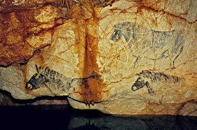
This has also been the case with many other canyons such as the Colorado River in the American southwest. In the canyons along the Colorado River, the Glen Canyon dam and the Hoover dam as well as other projects have submerged thousands, if not tens of thousands, of rock art and other archaeological sites. This will not always need to be considered a negative effect however. Perhaps being underwater, however, will protect rock art from vandalism. I recall hearing a report from one rock art recording project in northern New Mexico decades ago, in the neighborhood of the Navajo Lake Reservoir that had submerged many rock art and other cultural sites. When their Navajo guide was asked what he thought about their sites and rock art being submerged under hundreds of feet of water he was reportedly quoted as having replied “It’s safe from you now.”

NOTE: Once again RockArtBlog wishes to thank Sachin Tiwary for his cooperation in this, and permission to cite his paper (below) and use his photographs. This effort would be incomplete without his assistance, and would not have happened without his original inspiration.

ALSO: Some images in this posting were retrieved from the internet with a search for public domain photographs. If any of these images are not intended to be public domain, I apologize, and will happily provide the picture credits if the owner will contact me with them. For further information on these reports you should read the original reports at the sites listed below.

REFERENCES:

Faris, Peter, 2020 George Washington May Have Seen These Ohio River Petroglyphs, November 7, 2020, https://rockartblog.blogspot.com/search/label/George%Washington

2011 Rock Art of Lewis and Clark, December 31, 2011, https://rockartblog.blogspot.com/search/label/Lewis%20and%20Clark

Grant, Campbell, 1967 Rock Art of the American Indian, Promontory Press, New York

O’Brien, Dan, 2020 Learn the Mystery of the Ohio River Petroglyphs,The Business Journal, Youngstown, Ohio, https://businessjournaldaily.com/mystery-of-ohio-river-petroglyphs/

Tiwary, Sachin Kr., 2014 Underwater Rock Art: In Global Context, En Rupestreweb, http://www.rupestreweb.info/underwaterrockart.html


Saturday, January 16, 2021

UNDERWATER ROCK ART - PART 2, ROCK ART IN THE PROCESS OF BEING SUBMERGED:

The major factor in natural coastal rock art submersion is climate change, the warming of the earth by the addition of greenhouse gases to the atmosphere. “Global mean sea level has risen about 8-9 inches (21 - 24 centimeters) since 1880, with about a third of that coming in just the last two and a half decades. The rising water level is mostly due to a combination of meltwater from glaciers and ice sheets and a thermal expansion of seawater as it warms. In 2019, global mean sea level was 3.4 inches (87.61 mm) above the 1993 average - the highest annual average in the satellite record. From 2018 to 2019, global sea level rose 0.24 inches (6.2 millimeters).” (Lindsey 2020) Sites that currently lie just a few inches to a few feet above mean sea level will inevitably become submerged as rising waters continue to creep up year by year.


View of Alta fjord, Norway. Photo Ralph Frenken, 2012, from Donsmaps.com


Alta fjord, Norway, Googleearth, Don Hitchcock, Donsmaps.com.

One rock art site listed by Tiwary (2014) is the Alta Fjord site in Norway which, although currently exposed, he expects to be submerged by rising sea-levels. “The World Heritage Rock Art in Alta is a rich cultural monument consisting of several carvings and paintings localized in the inner parts of Altafjord in Finnmark, Norway. The rock art in Alta was made over a period of time from 4200 B.C. to 200 A.D. After a few years it may get submerged into the sea.” (Tiwary 2014)


Alta fjord rock art, Norway. Internet photo, whc.unesco.org.


Alta fjord, Norway. Photo Ralph Frenken, 2012, From Donsmaps.com.

“The Alta site is at the head of the fjord, and is very well protected from the swells of the Norwegian Sea. The depth of the fjord increases rapidly from about 60 metres close in shore to more than 400 metres further out in the fjord. It was used as an anchorage by the German battleships Tirpitz and Scharnhorst in 1943 during WWII.” (Hitchcock 2019)

“At the end of the last ice age, the land ‘rebounded’ after the bulk of the ice melted, and so this part of Norway slowly lifted by a process known as isostasy. The ice sheet reached its greatest extent and thickness 20,000 years ago, and most melting occurred between 16,000 and 10,000 years ago. This uplift did not stop when the ice had melted, it continues to this day.” (Hitchcock 2019)

This isostasy will be competing with the sea-level rise caused by global warming, but the projections for sea-level rise suggest that it will win the competition and that the Alta petroglyphs are eventually as doomed as the other sites I have listed.


Waianae coast, Oahu, Hawaii. Online photo from LiveScience.


Waianae coast, Oahu, Hawaii. Internet photo, Public Domain.


Waianae coast, Oahu, Hawaii. Internet photo, Public Domain.


Waianae coast, Oahu, Hawaii. Internet photo, Public Domain.


Waianae coast, Oahu, Hawaii. Internet photo, Public Domain.


Waianae coast, Oahu, Hawaii. Internet photo, Public Domain.

There are many other rock art sites that sit near sea level that will become underwater rock art  sites with continued sea-level rise. One site is a recently discovered petroglyph site on Hawaiia’s Waianae coast on Oahu. “Archaeologists from the Hawaii Department of Land and Natural Resources and the U.S. Army have been working together to record and document the petroglyphs; which now number at least 17 figures.” (Sci-News 2016) The figures stretch over sixty feet of beach. These figures are on the beach and were covered by sand until recently and, depending on wave action and storms, may be covered again. A few inches of sea-level rise, however, will submerge them.


Petroglyph Beach, Wrangell, Alaska. Photo Peter Faris, August 2, 2001.


Orca petroglyph, Wrangell, Alaska. Photo                    Peter Faris, August 2, 2001.

Another major petroglyph site which will inevitably be covered by sea-level rise is Petroglyph Beach at Wrangell, Alaska. Produced by the Tlingit people it is representative of much of the rock art on the northwestern coast of North America.


Bird petroglyph, Wrangell, Alaska. Photo Peter Faris, August 2, 2001.

  
Mask petroglyph, Wrangell, Alaska. Photo                     Peter Faris, August 2, 2001.

“While Tlingit rock art (especially petroglyphs) may sometimes have been made to attract the salmon, the figures include clan crests, ancestors, mythological figures and sailing ships, as well as symbols of wealth or victory. Tlingit rock art may, like the elaborate totemic figures on poles and house screens, serve as illustrations of important events, mythic or historical, in the clan traditions and so bear witness to the achievements, wealth, or supernatural powers obtained by the clan ancestors.” (De Laguna 1990:215) Of the rock art at Petroglyph Beach, the figures are pecked and carved into basalt boulders on the beach. Many of them seemingly consist of masklike faces, but the famous orca there is undoubtedly a clan figure as described above. Again, if left as they are, a foot or two of sea level rise will submerge almost all of them.

Undoubtedly many other locations like this exist. It has not been my intention to present a complete catalog of threatened rock art sites, but to present a different angle to rock art conservation, one not commonly considered. Next week I will discuss some rock art sites that are underwater as a result of human, not natural, activity.

NOTE: Some images in this posting were retrieved from the internet with a search for public domain photographs. If any of these images are not intended to be public domain, I apologize, and will happily provide the picture credits if the owner will contact me with them. For further information on these reports you should read the original reports at the sites listed below.

Additionally - I wish to express my gratitude to Dr. Sachin Tiwary for his permission to quote his study as well as reproduce images from it.

REFERENCES:

De Laguna, Frederica, 1990 Tlingit, pp. 203-228, in Handbook of North American Indians, Volume 7, Northwest Coast, Wayne Suttles, editor, Smithsonian Institution, Washington D.C.

Hitchcock, Don, 2019, Norwegian Rock Art - Alta Fjord, Don’s Mapshttps://www.donsmaps.com/norge.html

Lindsey, Rebecca, 2020, Climate Change: Global Sea Level, National Oceanic and Atmospheric Administration (NOAA), https://www.climate.gov

Staff, 2016 400-Year-Old-Petroglyphs Found on Hawaii Shoreline, Ausust 11, 2016, www.sci-news.com

Tiwary, Sachin Kr., 2014 Underwater Rock Art: In Global Context, En Rupestreweb, http://www.rupestreweb.info/underwaterrockart.html

Saturday, January 9, 2021

UNDERWATER ROCK ART - PART 1, NATURALLY DROWNED ROCK ART:

Post-glacial sea level rise, Wikipedia.

The idea for his column originated with the concept of rising coastal water levels as global ice-melting caused by climate change continues. Some shoreline rock art will be lost as water levels rise. This has been happening for many millennia with gradual warming of the earth, but the newly emerged phenomenon of human-cause climate change has accelerated the problem significantly. According to Wikipedia, “since the last glacial maximum about 20,000 years ago, the sea level has risen by more than 125 metres (410 ft), with rates varying from less than a mm/year to 40+ mm/year, as a result of melting ice sheets over Canada and Eurasia. Rapid disintegration of ice sheets led to so called ‘meltwater pulses’, periods during which sea level rose rapidly. The rate of rise started to slow down about 8,200 years before present; the seal level was almost constant the last 2,500 years, before the present rising trend that started at the end of the 19th century or the beginning of the 20th." (Wikipedia)

The implication of this is that many rock art sites that were originally on dry land are now submerged. Or, to restate this from the other way, because of past sea level rise there are possibly now huge numbers of rock art sites to be discovered offshore, underwater.


Traverse Bay, Michigan, Photo Mark Holley, 2015.


Traverse Bay, Michigan. Internet photo, Public Domain.


        Traverse Bay, Michigan. Internet                       photo, Public Domain.

One, which has been reported at Grand Traverse Bay (Michigan), in Lake Michigan, is called the “Stonehenge of the Great Lakes.” There, some forty feet underwater are a number of upright stones forming a partial circle, with what appears to be a mammoth carved on one of the stones (Puiu 2017). The discovery was made in 2007 and reported by Mark Holley, a professor at Northwestern Michigan College in Traverse City (Hardy 2015).

Some examples have been published in Tiwary’s 2014 paper “Underwater Rock Art: In Global Context” (see references). Tirwary’s paper deals with the aspect of Marine Archaeology that he calls ‘underwater rock art.’ “It refers to those rock art sites which had existed on the coastal plains or on the fringes of water bodies which in due course of time got submerged into the waters due to various reasons, the cause of which may be natural such as changes in the earth’s crust and the subsequent raise of the water level or even Man-made such as due to modern developmental projects. So this specialized field of Rock Art Studies deal with those paintings which already got submerged or on the verge of submersion and analysis its various problems such as the causes of submersion (if natural), it’s preservation and conservation problems, methods adopted for its exploration and documentation, etc.” (Tiwary 2014)


Farne Islands, Northumberland, UK. Photos Ben Burville, 2007, internet photo.


Farne Islands, Northumberland, UK. Photo Ben Burville, 2007, from Tiwary.

Tirwary’s first example is a gridlike pattern found on a rock underwater in the Farne Islands, Northumberland, UK, by a diver named Ben Burville. “During February, 2007 Mr. Ben Burville noticed some interesting carving on the rock about 20ft (7m) underwater off the Farne Islands in Northumberland. - One thing should be noticed is that the site is a few miles off shore and no sign of human activity can be seen in the area. It is at the base of a rock formation that forms part of the Outer Farnes. The rock seems to be the same as the local rock in the same vicinity. - An explanation for the absence of patina marks on it has been given in the following way. As the rock has been covered by sand for most of the time, the sand may have scoured the stone and if the marks had been buried in enough sand, it might have stopped oxygen getting to the stone to cause patination. It mbe possible during glacial episodes sea levels were up to more than 139m below present day sea level. Most of the southern North Sea was dry land so it is feasible that rock art could have been done on land and now it is below sea level. It all depends on the date of the work.” (Tiwary 2014) (A short video of this can be seen at https://www.youtube.com/watch?v=kP7BeNVVBM0)


Cosquer Cave elevation. Wikipedia.


Cosquer Cave, France. Photos Bradshaw Foundation.

One famous location where we can assumed there once was rock art but it is now underwater is the entrance to Cosquer Cave. “In July 1991 Dr. Jean Clottes, an English teacher (Honorary President of the French Prehistoric Society, Scientific Advisor for Prehistoric Art, Director of Prehistoric Antiquities) and a deep sea diver Henri Cosquer discovered paintings and engravings in a cave beneath the sea near Marseilles (France) on the Mediterranean coast. The gallery slopes up for about 360 feet under water before reaching a huge chamber that partly remained above the sea where many prehistoric paintings and engravings are preserved on the walls.” (Tiwary 2014) Based upon our knowledge of other Paleolithic painted caves I think we can assume that rock art would have originally been distributed throughout the whole of the original cave, meaning that much rock art was probably located in the 360 foot sloping gallery before it was flooded by rising sea levels.


Underwater Rock Art, Melanesia. Photos Christophe Sand, from Tiwary.


Closeup of underwater Rock Art, Melanesia. Photos Christophe Sand, from Tiwary.

Another location of rock art that had been apparently created on the shore but is now submerged in the sea is found in the South Pacific. “Recently most archaeological research program in Island Melanesia had been concerned with first settlement sites having rock art. About 3000 engravings had been noticed on the sea shore and some are now submerged in the sea.” (Tiwary 2014)

These are only a few in what must be a much larger number of submerged rock art sites, with many waiting to be discovered. Not only has rock art been submerged by sea-level rise, some rock art has been inundated by human hydrological projects. Dams, in particular, have covered large numbers of pictographs and petroglyphs under water. This will be the subject in part two of this exploration.

NOTE: Some images in this posting were retrieved from the internet with a search for public domain photographs. If any of these images are not intended to be public domain, I apologize, and will happily provide the picture credits if the owner will contact me with them. For further information on these reports you should read the original reports at the sites listed below.

Additionally - I wish to express my gratitude to Dr. Sachin Tiwary for his permission to quote his study as well as reproduce images from it.

REFERENCES:

Hardy, Mike, 2015 Great Lakes Stonehenge, November 27, 2015, https://thumbwind.com

Puiu, Tibi, 2017 Stonehenge-Like Structure Found Under Lake Michigan, January 26, 2017, https://www.smescience.com

Tiwary, Sachin Dr., 2014 Underwater Rock Art: In Global Context, En Rupestreweb, http://www.rupestreweb.info/underwaterrockart.html

Wikipedia, Past Changes in Sea Level, https://en.wikipedia.org/wiki/Sea_level_rise

Saturday, January 2, 2021

COLOMBIAN ROCK ART CLAIMED TO DEPICT EXTINCT MEGAFAUNA:


     Serranía La Lindosa pictographs, online                     image, Public Domain.

In Colombia, the discovery of a huge concentration of rock art has been announced.


Serranía La Lindosa pictographs, online image, Public Domain.

“A research team published the description of tens of thousands of ice age paintings, many apparently depicting extinct megafauna, discovered in a remote region of the Amazon forest. The paintings cover almost 8 miles (12 km) of a cliff face making it one of the largest rock-art sites on the planet. The site of the discovery, the Serranía La Lindosa, sits deep in the rebels-controlled Columbian rainforest. The discovery by a British-Colombian team of archaeologists was made last year - - ." (Bressan 2020) Serranía La Lindosa translating roughly as beautiful mountains.


     Serranía La Lindosa pictographs, online                     image, Public Domain.

According to a preliminary survey,"there are several tens of thousands of images covering the rocks smoothed by fluvial erosion. The images include animals like fish, turtles, lizards and birds, as well as people dancing and holding hands, among other scenes and abstract symbols.” (Bressan 2020)

The team that carried out the research was bi-national and consisted of Jose Iriarte and Mark Robinson from the University of Exeter, Gaspar Morcote-Rios and Jeison L. Chaparro-Cardenas from the Universidad Nacional de Columbia, and Francisco Javier Aceituno from the Universidad de Antioquia. (University of Exeter) The team worked in a region that had been closed until recently because of fighting between Colombia governmental troops and FARC guerillas.

“This is one of the largest collections of rock art found in South America. The recorded drawings, likely first made around 12,600 and 11,800 years ago, are on three rock shelters on hills in the Colombian Amazon. The paintings, identified during landscape surveys, also depict geometric shapes, human figures, and handprints, as well as hunting scenes and people interacting with plants, trees, and savannah animals. The vibrant red pictures were produced over a period of hundreds, or possibly thousands, of years. Some are so high, and inaccessible, special ladders crafted from forest resources would have been needed and they would have been obscured from view for anyone visiting the rock shelter.” (University of Exeter 2020)

The images include geometric shapes, anthropomorphs, and zoomorphs, among others, but what most interests me here are the pictures of animals that appear to illustrate extinct megafauna from the Paleolithic period.


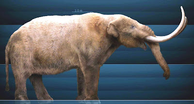
Megatherium and baby, Marcote-Rios et al, 2020.


Megatherium reconstruction, online image, Public Domain.

“There are drawings of deer, tapirs, alligators, bats, monkeys, turtles, serpents, and porcupines, as well as what appears to be Ice Age megafauna. These now extinct animals are depicted in rock art in Central Brazil, but experts believe these drawings are more realistic. There are depictions of creatures resembling a giant sloth, mastodon, camelids, horses, and tree-toed ungulates with trunks. These native animals all became extinct, probably because of a combination of climate change, the loss of their habitat and by hunting by humans.” (University of Exeter 2020)


Extinct horse (Hippidion), Marcote-Rios et al, 2020.


       Hippidion reconstruction, online image,                      Public Domain.

By all accounts a spectacular find, and a rock art site of major importance. The problems, however, begin when we look at the supposed images of the Ice Age megafauna supposedly depicted. "Potential ice-age megafauna species displayed in the pictographs include a giant ground sloth with its young, a mastodon, a prehistoric relative of the elephant, an early horse (Hippidion?) walking alongside an unidentified camelid, maybe of the genus Paleolama, and a long necked, three toes ungulate with a trunk, maybe Zenorhinotherium or Macrauchenia." (Bressan 2020)


Proposed paleolama pictograph, Marcote-Rios et al, 2020.


        Paleolamareconstruction, online image,                    Public Domain.

“We started seeing animals that are now extinct. The pictures are so natural and so well made that we have few doubts that you’re looking at a horse, for example. The ice-age horse had a wild, heavy face. It’s so detailed, we can even see the horse hair. It’s fascinating.” (Alberge 2020)


Proposed mastodon pictograph, Marcote-Rios et al, 2020.


        Mastodon reconstruction, online image,                      Public Domain.

The sloth is actually fairly convincing as well as the extinct horse. The pictographs look very much like the actual creatures. The other animals identified may or may not actually be accurate. The "mammoth," the "Paleolama" and the "Zenorhinotherium or Macrauchenia" strike me as much more of a guess than a distinct identification.


Proposed Zenorhinotherium or Macrauchenia pictograph, Marcote-Rios et al, 2020.


       Macrauchenia reconstructions (hairy and shorthaired), online image, Public Domain.

It is always exciting to find a record that illustrates extinct animals, and this discovery, because of its large scale, provides a wealth of new possibilities for research. While some of the illustrations of extinct creatures are easy to identify, others take a little more imagination. All in all though, this is a world class, major discovery.

NOTE: Some images in this posting were retrieved from the internet with a search for public domain photographs. If any of these images are not intended to be public domain, I apologize, and will happily provide the picture credits if the owner will contact me with them. For further information on these reports you should read the original reports at the sites listed below.

REFERENCES:

Alberge, Dalya, 2020, “Sistine Chapel of the Ancients” rock art discovered in remote Amazon Forest, 29 November 2020, The Guardian.

Bressan, David, 2020, A Treasure Trove of Rock Art Depicting Extinct South American Megafauna Discovered in Amazon Forest, https://www.forbes.com

University of Exeter, 2020, Newly Discovered Amazon Rock Art Shows the Rainforest’s Earliest Inhabitants Living With Giant Ice Age Animals, December 1, 2020, https://phys.org/news/2020-12-newly-amazon-art-rainforest-earliest.html