Saturday, November 28, 2020

ROCK ART IN SAUDI ARABIA:


Neolithic hunt, 7th millenium BC. hunter, hounds, 2 buffalo, leopard on right, Jabal Raat Shuwaymis, p. 18.

A fascinating article by  Christopher Baumer in the August/September 2020 issue of World Archaeology Magazine gives a relatively complete introduction to rock art of the Saudi Arabian desert interior and new discoveries by recent expeditions.


Neolithic anthropomorph with a boomerang Talaat al-Salaby, Great Nefud desert. p. 21

“The interior of Saudi Arabia is a land of sweeping deserts and unforgiving climate. In the south lies the Rub’ al-Khali - the Empty Quarter, which is the largest pure-sand desert in the world - while the north holds the Great Nefud Desert. Its sea of reddish to light-beige sand is rimmed by a belt of sandstone mountains and outcrops. Rain is minimal, with less than 100 ml falling per year, against an evaporation potential of about 4,500 ml a year. But, as with the Sahara or the Taklamakan deserts, earlier climatic conditions in Arabia were not as hostile to life as those prevailing today. Examining former lake sediments indicates that the Arabian peninsula experienced several climate fluctuations. Back in the Chibanian and Upper Pleistocene periods, for example, lakes existed in the Nefud around 410kya (‘thousand years ago’), 320 kya, 125 kya, and 100kya.” (Baumer 2020:16)


Talaat al-Salaby, in the Great Nefud desert. Bronze age  male and female pastoralists over earlier long-horned bull and ibexes, p. 16.

These climatic shifts and changes in weather patterns can be dated through sediments in relic lake beds. These dates can then be compared with the types of animals pictured on rock faces to give rough chronologies for the rock art - some types of animals would only have been there in wetter conditions, others favored dryer conditions, etc.

“Dating rock art is notoriously difficult, but in Saudi Arabia many motifs are only known to appear in specific time periods, so they can offer a rough indication of their age. As Maria Guagnin has shown the use and reuse of some rockfaces as a canvas for this artistry has created superimposed banks of imagery dating to many different periods. Such palimpsests make it possible to sketch a relative chronology, which can then be connected with the direct dating achievable through archaeology.” (Baumer 2020:17)

“Rising temperatures at the beginning of the Holocene, around 10,000 BC, vanquished the colder and very dry climate of the Late Pleistocene. Arabia also experienced a moist period, mainly driven by the Indian Ocean Monsoon Current extending north-west. This first makes its mark on the south-eastern portion of the Arabian peninsula, but after a lag of c.1,700 years the Nefud Desert began receiving summer monsoons too, although in reduced quantity. Lakes formed, which were replenished in the winter months by rainfall delivered by Mediterranean westerly cyclones, and the landscape duly resembled a savanna more than a desert.” (Baumer 2020:17)


A crucifix image found near the Wadi al-Naqha, Rub’ al-Khali, p. 23. 

Changing climactic conditions as well as cultural evolution led to a series of changing cultures, and this is illustrated in the rock art.

“As this rapid overview reveals, the relation between climate, economy, and rock art can be divided into six phases:

•  First, in the wet, early Holocene, a hunter-gatherer economy is reflected in petroglyphs featuring hunting and wild carnivores and herbivores.

•  Second, in the era of Neolithic pastoralism, when the region still enjoyed a relatively humid climate, images of pastoralists and domesticated cattle and goats predominate.

Late Bronze Age rock art found during our expedition. In the Misma South region of the Great Nefud Desert


Late bronze age boat, northern half of the great ridge at Hafirat Laqat, Nefud Desert, p. 20

•  Third, in the late Neolithic and Bronze Age, the resurgence of arid conditions led to a decline of semi-settled pastoralism and a resumption of hunting, mirrored in the use of bows and arrows, as well as spears, to kill goats, gazelles, and wild dromedaries.


Wadi al-Naqha, apparent female moon deity (on the left), a musician playing a lyre, and a standing warrior holding three spears; in his belt is a lunate pommel dagger, probably later Iron Age in date.

•  Fourth, in the Iron Age, the domestication of the dromedary brought a new mobility to the region. Rock Art now featured dromedaries and donkeys, as well as numerous brief inscriptions, the latter probably carved by travelling merchants.


“Bedouin horsemen attacking with long lances at Fardat Sheyban, Rub’ al-Khali. Each lance has discs behind the iron tip to prevent it from penetrating so far into an enemy’s body that it can no longer be pulled free.”, p. 19

•  Fifth, in the pre-Islamic period, continued aridisation led to increasingly bellicose societies. This development is mirrored in battle scenes and duels involving mounted lancers and archers, as well as infantry.

•  The sixth, contemporary phase of rock art shows hunters armed with guns, as well as cars and trucks.” (Baumer 2020:19)


A visual pun, a rounded swastika or double cross made of four ibex, p. 20.

Presumably in Baumer’s fifth period, the increase in combat and warfare seen in rock art would have been largely influenced by the drying up of water resources over time and the struggle to dominate the shrinking resource.

Saudi Arabia’s rock art not only documents the changing lifestyles of inhabitants over the millenia, it also records the fauna and flora. Inscriptions in a number of languages document the various cultures and religious symbols and inscriptions attest to the people’s beliefs at various times and places. All in all, it provides a very rich record of the people and cultures of this region over at least ten thousand years.

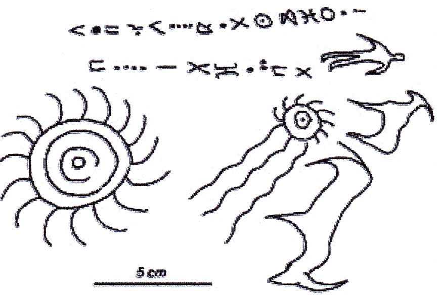
NOTE: These photos are all from the article "Saudi Arabian Rock Art", pp 16 - 23, World Archaeology magazing.

REFERENCE:

Baumer, Christopher, 2020 Saudi Arabian Rock Art, pp. 16-23, World Archaeology Magazine, Issue 102, August/September 2020, Vol. 9, No. 6

Saturday, November 21, 2020

NEOLITHIC PETROGLYPHS AT QUBBET-EL-HAWA, EGYPT:


Qubbet El-Hawa, Egypt. Photo David Sebel.

A recently discovered petroglyphs at Qubbet El-Hawa (Cave of the Winds) along the Nile river in Egypt is estimated to be 6,000 years old. "The image, discovered recently by archaeologists, provides a tantalizing glimpse of Egypt's Neolithic period, or Stone Age. It likely dates back to the latter half of the fourth millenium B.C., said Ludwig Morenz, and Egyptologist at the University of Bonn in Germany." (Pappas) This date would mean that the images at Qubbet El-Hawa predate the pharaohs and provide a glimpse into very early life along the Nile river.


     Qubbet El-Hawa, Egypt. Photo David             Sebel - photo enhanced.

"Qubbet el-Hawa is a site on the western bank of the Nile, opposite Aswan. The name is derived from the dome of the tomb of an Islamic sheikh, but archaeologically, it is usually understood as referring to the site of the tombs of officials lined up on artificial terraces below the summit of the Nile bank upon which the Islamic tomb stands." (Wikipedia)


Panel with conceptual drawing of what they think they see. David Sabel.

"The scene is interpreted by Morenz as a hunter with a bow standing next to an ostrich. On the other side of the ostrich is a person who seems to be wearing an ostrich mask. Morenz believes that the person might be a shaman and the mask-wearing might indicate ritual purposes." (Pappas)

Actual tracing of the panel. David Sabel.

"The images were pecked into the rock with a hard point and are now barely perceivable due to their considerable age. Only the archaeologically precise recording of the traces and the drawing of outlines revealed the images with noteworthy iconography. The initially confusing-looking arrangement of dots allows three figures to be seen upon closer inspection: a hunter with bow, and dancing man with raised arms, and between them, an African ostrich. 'The archer clearly shows hunting for the large flightless bird, while the man with raised arms can be identified as a hunt dancer,' reports Prof. Morenz. The dancer apparently wears a bird mask. The scene is reminiscent of the conceptual world of hunting, masks, and shamanism, as known from many parts of the Earth - including ostrich hunting by what are known as San (bushmen)." (University of Bonn 2017)

While I agree that they have found petroglyphs, to identify these figures in such detail does not seem to me to be warranted. Looking at the photographs and the field drawings the best I can say is that there seem to be three figures. Yes, one of them appears to have a bow, and the one in the center might be an ostrich, but that is pushing the limit of reasonable interpretation. I see nothing to suggest dancing and there is no indication of mask wearing. I fear that we have another case of Pareidolia, perhaps perhaps combined with an example of the Availability Heuristic.

“The availability heuristic involves making decisions based upon how easy it is to bring something to mind. When you are trying to make a decision, you might quickly remember a number of relevant examples. Since these are more readily available in your memory, you will likely judge these outcomes as being more common or frequently-occurring.” (Cherry 2020)  While I cannot know this for certain I suspect that Professor Morenz has, at some point, studied examples of San rock art which not only include ostriches, but are sometimes interpreted as showing ecstatic dancing, so this is what he saw. Pareidolia is the tendency of the human mind to interpret something as a familiar object - the old pony in the clouds, for example - and Morenz was looking for the meaning of the pecking on this panel. Not that I can say that his interpretation could not be possible, just that I don’t think he has enough data to make such definitive statements.

So, while I congratulate the team on a discovery that is significant, and important to Egyptian prehistory, I must say that I cannot agree with their interpretation based upon the evidence available.

NOTE: Some images in this posting were retrieved from the internet with a search for public domain photographs. If any of these images are not intended to be public domain, I apologize, and will happily provide the picture credits if the owner will contact me with them. For further information on these reports you should read the original reports at the sites listed below.

REFERENCES:

Cherry, Kendra, 2020 Heuristics and Cognitive Biases, https://www.verywellmind.com/what-is-a-heuristic-2795235

Pappas, Stephanie, 2017 Ancient Rock Carvings Depicting Masked People Discovered in Egypt, March 24, 2017, Live Science, http://www.livescience.com/58394-ancient-egyptian-rock-carvings-discovered.html?utm_source=ls-newsletter&utm_medium=email&utm_campaign=20170324-ls

University of Bonn, 2017 Egyptian Ritual Images from the Neolithic Period, March 22, 2017, https://phys.org/news/2017-03-egyptian-ritual-images-neolithic-period.html

https://en.wikipedia.org/wiki/Qubbet_el-Hawa

Saturday, November 14, 2020

PETROGLYPHS SUGGESTING THAT METEORS WERE RECORDED IN ANCIENT MOROCCO ARE QUESTIONABLE:

Ida 1, Photo Abderrahmane Ibhi.

An article in online magazine Meteor News, on January 19, 2019, reported petroglyphs carved into stone recording a meteor fall in Morocco. The find in the rural village of Ida Oukazzou, in the Tiwrare area, about 100 km north of Agadir, Morocco, consisted of three rounded rocks named by the investigators Ida 1, Ida 3, and Ida 3.


Ida 2, Photo Abderrahmane Ibhi.

“The characteristics for Ida1 and Ida2: length 20 cm, width 17 cm, thickness 5 cm and length 18 cm, width 15 cm, thickness 5 cm respectively. These are two pebbles of melanocratic cryptocrystalline quartz sandstone of subcircular form and very flat. They show traces of corrosion and a surface calcification layer consisting of thin platelets of carbonates. After careful cleaning Ida 1 (brushing and vinegar), the only engraved side of this piece offers a spectacular scene of a man and a woman seemingly distraught by the fall of a meteor (Figure 1). Identically on Ida 2, not yet cleared of its gangue of clay and sand and under the secondary precipitation of carbonate layers, we can identify a scene that includes a fleeing anthropomorphic and a huge fireball (Figure 2).” (Abderrahmane et al. 2019:1)


Ida 3, Photo Abderrahmane Ibhi.


              Ida 3 drawing, Photo                                 Abderrahmane Ibhi.

“Ida 3 (length 35 cm, width 27 cm, thickness 12 cm) is a thin, leucocratic sandstone pebble, rather flat and more or less square in shape. After cleaning, Ida 3 symbolizes a scene that includes an anthropomorphic, two cattle of different sized, a meteor and a figurative of the Sun with concentric circles in the center. To complete this ideogram, the artist has arranged two lines of inscriptions with Tifinagh characters with dull incised lines (Figure 3), this showing an image-inscription association which is arranged in the empty interval where it integrates harmoniously. These Tifinagh inscriptions, difficult to translate, are quite old, it is impossible to date them accurately.” (Abderrahmane et al. 2019:2)

Here is where I begin to doubt the whole story. “The astronomical observations reveal that these sculptures are those of a meteor, the three petroglyphs seem to represent the impact of a great meteorite that has frightened the inhabitants and that the artist has certainly experienced this astronomical event spectacular enough to be recorded on the rock.” (Abderrahmane et al. 2019:2)

These just do not strike me as fully believable. They admit to a cleaning with brush and vinegar. This treatment removed the calcite (which might have been datable) and seems to have also removed any patination which have allowed other analyses to be made. There is no mention of the circumstances of the discovery, were they buried, face up or face down, where and when? We are not even given many details of their claimed examination “performed with a binocular magnifier equipped with an integrated digital camera.”  (Abderrahmane et al. 2019:1) Such an examination should have offered clear evidence of tool marks which would have provided a great deal of information. Were I examining a supposed petroglyph with a binocular magnifier with an integrated digital camera I would have photographs of tool marks to help determine questions of possible age and authenticity. From what I can see in the photographs provided I feel the lines are suspiciously even, suggesting that they were created with a metal chisel, but without close-up photographs I can never personally know.

These just do not look believable to me, short of being able to examine the carving and surfaces with magnification I will remain skeptical. Whether the authors perpetrated the fraud, or have been taken in by someone else’s fraud, I also do not know, but I will give them the benefit of the doubt on this one for now and assume that they are naive but innocent, but I just cannot buy it.

NOTE: Some images in this posting were retrieved from the internet with a search for public domain photographs. If any of these images are not intended to be public domain, I apologize, and will happily provide the picture credits if the owner will contact me with them. For further information on this report you should read the original report listed below.

REFERENCE:

Abderrahmane, Ibhi, Fouad Khiri, Lahcen Ouknine, Abdelkhalek Lemjidi, and El Mahfoud Asmahri, 2019 This Discovery of Mysterious Petroglyphs Suggests That a Meteor Has Been Observed in Ancient Times in Morocco, eMeteorNews, Vol. 4, Issue 1, January 2019

Saturday, November 7, 2020

GEORGE WASHINGTON MAY HAVE SEEN THESE OHIO RIVER PETROGLYPHS:


Smith's Ferry petroglyphs, Ohio River, Langdon, 1912.

In a country where “George Washington Slept Here” is almost a cliche
I was tickled to learn about a petroglyph panel along the Ohio River that he probably witnessed on a trip into the Ohio Territory in 1770.


     Smith's Ferry petroglyphs, Ohio River,                              Langdon, 1912.

“More than a decade after he left the army to become a gentleman farmer, George Washington traveled back to the frontier that figured so prominently in his early life. In the fall of 1770, Washington traveled westwards with his friend Dr. James Craik and three servants, traversing for nine weeks and one day. The trip was organized so Washington could view the lands that he earned in return for his service during the French and Indian war.” (Thompson) In other words his reward for serving the British Crown during the French and Indian War was a land grant that he was interested in visiting.


Lewis Evans' 1755 Map, Ohio River. Internet photo, public domain.


Lewis Evans' 1755 Map detail (the petroglyph site is labeled Antique Sculptures) Ohio River. Internet photo, public domain.

Washington’s actual journal entry on the day that he would have been by the petroglyphs was:

“21st. - Left our encampment about six o’clock, and breakfasted at Logstown, where we parted with Colonel Croghan and company about nine o’clock. At eleven we came to the mouth of the Big Beaver Creek, opposite to which is a good situation for a house, and above it, on the same side, that is the west, there appears to be a body of fine land. About five miles lower down, on the east side, comes in Raccoon Creek, at the mouth of which and up it appears to be a body of good land also. All the land between this creek and the Monongahela, and for fifteen miles back, is claimed by Colonel Croghan under a purchase from the Indians, which sale he says is confirmed by his Majesty. On this creek, where the branches thereof interlock with the waters of Shurtees Creek, there is, according to Colonel Croghan’s account, a body of fine, rich, level land. This tract he wants to sell, and offers it at five pounds sterling per hundred acres, with an exemption of quitrents for twenty years; after which, to be subject to the payment of four shillings and two pence sterling per hundred acres; provided he can sell it in ten-thousand-acre lots. At present the unsettled state of this country renders any purchase dangerous. From Raccoon Creek to Little Beaver Creek appears to me to be little short of ten miles and about three miles below this we encamped; after hiding a barrel of biscuit in an island to lighten our canoe.” (Sparks 1846)

Although Washington did not mention the petroglyphs he apparently explored the area as he designated one section as good for a house and others as fine cropland. Given Washington’s attention to the detail of the land it seems safe to assume that my would have had every opportunity to notice the petroglyph panel on horizontal sandstone in that area.


Smith's Ferry petroglyphs, Ohio River,                               Langdon, 1912.

The petroglyphs had been reported in 1755 by French travelers. “East Liverpool, Ohio - Chaussegros de Lery awoke on the morning of April 3, 1755, to find his encampment crusted with snow on what was to be a very cold day. About 10 a.m. the French Officer and his party moved across the Ohio Valley, navigating the terrain and streams as they made their way toward Fort Duquesne, then a French garrison at modern-day Pittsburgh. Around 3 p.m., de Lery recorded in his journal that the party crossed a river with which he was already familiar - he had encountered it 16 years earlier during a 1739 expedition under the command of Charles Le Moyne to Louisiana against the Chickasaw. ‘The river we left is called Riviere au Portrait, because at the mouth where it flows into the Belle Riviere, there are many signs and figures of men and animals chiseled on the rocks,’ he wrote. De Lery’s account presents one of the earliest written references to Native American carvings on a large, flat sandstone expanse at the confluence of the Ohio (Belle) River and Little Beaver Creek, which de Lery in 1739 named Riviere au Portrait, or ‘pictures in the river.’ ” (O’Brien 2020)

“For centuries, hundreds of these Native American carvings - or petroglyphs - stretched for about 10 miles along the Ohio River from Midland, Pa., through Wellsville, Ohio, to the Yellow Creek. - During the 1920s, a series of dams and locks was constructed along the Ohio, causing water levels along this part of the river to rise. By the 1950s, ‘super’ dams were added on the Ohio and the river rose even higher. Today, the petroglyphs are inundated under about 15 feet of water.” (O’Brien 2020)


      Smith's Ferry petroglyphs, Ohio River,                         Langdon, 1912.

“The local site is actually located about a mile north of Beaver Creek on the same shoreline of the Ohio. The town that was once there was known as Smith’s Ferry. A local historian in 1908 from East Liverpool pioneered research on this site and four others around the East Liverpool and Wellsville areas. His name was Harold Barth. Seventy years later the director of the Carnegie Museum of Natural History James Swauger wrote two major books documenting petroglyph’s up and down the Ohio river. It wasn’t until these books were published that things really came to light. Swauger used most of Harold Barth’s research, drawings, and photographs because they were the only available information known of any of the five sites. Most of the sites have been partially destroyed or covered over by 20 feet of river when dams were installed on the Ohio.” (Langdon 1912)


        Smith's Ferry petroglyphs, Ohio River,                       Langdon, 1912.

“On three occasions in 1940, 1948 and 1958, water levels along this part of the Ohio receded to a point where these images were exposed for the first time since the 1920s. For weeks, thousands of onlookers visited the stone outcrop near Smith’s Ferry, where the Little Beaver spills into the Ohio. The petroglyphs haven’t been viewed since. Yet many imprints of these markings survive. While some early photographs of the petroglyphs exist, the vast majority of the carvings are preserved thanks to the work of Harold Barth, and East Liverpool resident who in 1908 spent a year transferring the carvings onto large tracts of paper.” (O’Brien 2020)


    Smith's Ferry petroglyphs, Ohio River,                            Langdon, 1912.

Barth’s method of recording petroglyphs was quite unorthodox by today’s standards. He had a crew of helpers clearing the rock surfaces of mud, silt, and other debris. They then poured printers ink and a liquid dryer into the outline of each petroglyph, after which the large sheets of paper were pressed onto the surface. This process was followed at sites at Midland, Brown’s Island, Babb’s Island, Smith’s Ferry and Wellsville. The resulting collection of images is today in the possession of the Museum of Ceramics in East Liverpool, Ohio. (O’Brien 2020)

So, did George Washington see these petroglyphs? He certainly could have, he was there, but he apparently wrote nothing about them. As absorbed as he was in inventorying his land and dreaming about future wealth he probably was not very interested in something as mundane as the carvings of so-called “primitives.”

REFERENCE:

Langdon, Jeff, 1912 The Indian Rocks, The Petroglyphs of Smith’s Ferry, Keramos Vol. III, May 1912, East Liverpool, Ohio, reproduced in http://eastliverpoolhistoricalsociety.org/indianrocks.htm

O’Brien, Dan, 2020 Learn the Mystery of the Ohio River Petroglyphs,The Business Journal, Youngstown, Ohio, https://businessjournaldaily.com/mystery-of-ohio-river-petroglyphs/

Sparks, Jared, 1846 Journal of George Washington written during an expedition along the Ohio and Kanawha Rivers, extracted from The writings of George Washington, Volume II, Charles Tappan publ., Boston, pages 516-534