Showing posts with label archaeoastronomy. Show all posts

Saturday, April 27, 2024

ARCHEOASTRONOMY – POSSIBLE STELLAR ASTERISMS CARVED ON A STONE DISK:

Presumed star chart carved into a stone disc. Molaro and Bernardini, 2023.

The whole field of archeoastronomy is interesting, but a little like analyzing Rorsach Blots. What people see is influenced by what they expect (or want) to find when they are looking at possible examples. One good example is outlined in the citation below: 

“Two couples of stone disks found at the entrances and cemeteries of protohistoric hill forts in the north-eastern Adriatic area were suggested to have a symbolic meaning representing the Sun and the Night Sky. In one pair the night sky is symbolically represented by a number of natural holes made by marine bivalves but in the other stone studied here the marks are made by a human hand and show a pattern. We performed a statistical comparison of the chisel marks with the most common asterisms to try to establish if they were randomly made or they had some intentionality.” (Molaro and Bernardini 2023:11) Notice that Molaro and Bernardini said “the night sky is symbolically represented by a number of natural holes made by marine bivalves.”  In other words, clams or barnacles have bored into the surface of a piece of stone in the pattern of asterisms in the night sky. The authors used statistical analysis to identify the patterns. Any time statistics enters the picture I get skeptical. A good mathematician can use statistics to make the answers come out any way they wish. I wonder if the marine bivalves also used statistics to plot where they should bore their holes.


Front face of the stone disk from an adaptation of Bernardini et al. (2022). Curvature map of the disk with the position of the chiselmarks indicated by black circles and numbered.

The whole pattern is composed by 29 chisel marks, 24 in the front face of the stone and 5 on the back. 28 chisel marks are consistent with the asterisms of Scorpius, Orion, Pleiades and, perhaps, of Cassiopeia on the back side of the stone. The correlation between the chisel marks and the stellar position is very high with r(28) = 0.994. The p-value is formally 0.001 and provides a very low probability that the chisel marks were produced accidentally.” (Molaro and Bernardini 2023:11) The authors suggest the age of these stones as Bronze Age. They also state that there are no written records from the local cultures during that time period. I, then, need to ask how they can know what stellar asterisms the inhabitants of the hill fort would recognize and wish to record?

One chisel mark remains without an obvious identification. This is the most problematic chisel mark to explain.The mark is close to the stellar system of 𝜇 Ori, formed by two physical binary systems with an integrated magnitude of V = 4.1. Alternatively, if it belongs to the portion of sky of Scorpius it  could be associated to 𝜖 Sgr. However, all these identifications are quite unsatisfactory. One intriguing possibility is that a bright star was present in that position that produced a supernova or more likely a failed supernova leaving a black hole as a remnant. Interestingly, this prediction could be tested through detailed observations and, therefore, specific studies are solicited.” (Molaro and Bernardini 2023:11) One mark does not fit their theory, therefore, it may have disappeared in the interim in a supernova? This strikes me as really stretching to make your point.

The stone next to the diagram of the chisel marks.

The asterisms are quite complete showing all the bright stars. Notable missing are 𝛾 and 𝜅 Ori. However, the location is in the most exposed part of the stone and the mark could have been possibly deleted by stone erosion.” (Molaro and Bernardini 2023:11) Even more convenient, not only has a supernova since made one star disappear that was carved onto the stone, but erosion has removed a couple of important stars that should be there.

The deviations from real positions are of about one degree which are comparable with the size of the marks in the stone. For comparison, in the catalogue of Ptolemaios the error distributions is of 27 and 23 arcmin in longitude and latitude respectively, which is only about a factor 2–3 better than those on the stone. This requires a careful preparation and patient persistence in the execution. As such, the reproduction is not symbolic but faithful, showing an effort in providing the true stellar positions in the sky.” (Molaro and Bernardini 2023:11-12)

 "The hill fort of Rupinpiccolo was in use from about 1800/1650 BCE. Several data suggest to link the stones to the early building phase of the hill fort during the Bronze Age, even if we cannot completely rule out a Roman origin based on the similarity of the disks with roughed-out blocks of tomb stones. Even for the latest photohistoric chronology (400BCE), the disk stone would represent one of the oldest cartography of the sky." (Molaro and Bernardini 2023:12) If it really was a chart of stellar positions in the  sky.

Now, all of this may, in fact, be true, but I am not convinced. These stone disks may be ancient star charts with all of this archeoastronomical data recorded on them. The authors pointed out a likeness of these stone disks to covers for Roman Era shaft tombs, and we know the Romans recognized many of the same asterism as we do. However, after the work of Bernardini et al. (2022), round stone artefacts of similar shape and dimensions were identified in the collection of the Museo Archeologico Nazionale di Aquileia. Probably they are roughed-out blocks for lids for circular tombstones. Since the exact archaeological context of the stones from Rupinpiccolo cannot be determined with precision, the possibility of Roman origin cannot be ruled out.” (Molaro and Bernardini 2023:2) I truly do not know any of this with any real certainty, and I submit, the Molaro and Bernardini may be a little too eager in their interpretations. At least they admit to a certain amount of speculation. After their paper was released popular press stories popped up which address this whole question as the proven truth. Which takes me back to the Rorsach Blots – we see what we want to see.


NOTE 1: I have ommitted some of the secondary citations from the quotations. The one listed is cited in the caption of the second illustration, but I did not consult it directly.

NOTE 2: Images used are from the Primary Reference paper.  by Molaro and Bernardini.


PRIMARY REFERENCE:

Molaro, Paolo, and Frederico Bernardini, 2023, Possible stellar asterisms carved on a protohistoric stone, 6 November 2023, Astronomical Notes (Astron Nachr), DOI:10.1002/asna.20220108. Accessed online 25 December 2023.

SECONDARY REFERENCE:

Bernardini, F., Vinci, G., Macovaz, V., Baucon, A., De Min, A., Furlani, S., and Smolic, S., 2022, Doc Praehist, XLIX, 2.

Saturday, November 3, 2018

ANOTHER BOGUS PALEOLITHIC STAR MAP - THE ACH VALLEY TUSK:


Ach Valley carved mammoth
ivory, www.astronomytrek.com.
Public domain.

There is an old piece of advice that states "if you can't say something nice about someone, don't say anything at all." This is obviously very good advice for human interaction, but there are circumstances where erroneous or dangerous ideas are being passed on, that I believe must be called out for what they are. I have recently been writing a series of columns about the theories of Dr. Michael Rappenglueck, who identifies star charts in Paleolithic art. I have tried to patiently point out what I think are the flaws in his reasoning and shown how I disagree with his conclusions. This example, however, is even shakier than the others.

The Ach Valley Tusk is a piece of mammoth ivory, recovered from Geißenklösterle Cave near Ulm, Germany, that has a human figure carved into one side and a series of 86 pits or notches cut into the other. Rappengluek identified the human figure as a star map representing the constellation Orion.


Constellation Orion star chart,
www.ancient-origins.net,
Public Domain.

"Orion is a prominent constellation located on the celestial equator and visible throughout the world. It is one of the most conspicuous and recognizable constellations in the night sky. It was named after Orion, a hunter in Greek mythology. Its brightest stars are Rigel (Beta orionis) and Betelgeuse (Alpha orionis), a blue-white and a red supergiant, respectively.
The earliest depiction that has been linked to the constellation of Orion is a prehistoric (Aurignacian) mammoth ivory carving found in a cave in the Ach valley in West Germany in 1979. Archaeologists have estimated it to have been fashioned approximately 32,000 to 38,000 years ago. The distinctive pattern of Orion has been recognized in numerous cultures around the world, and many myths have been associated with it." (wikipedia.org/wiki/Orion)


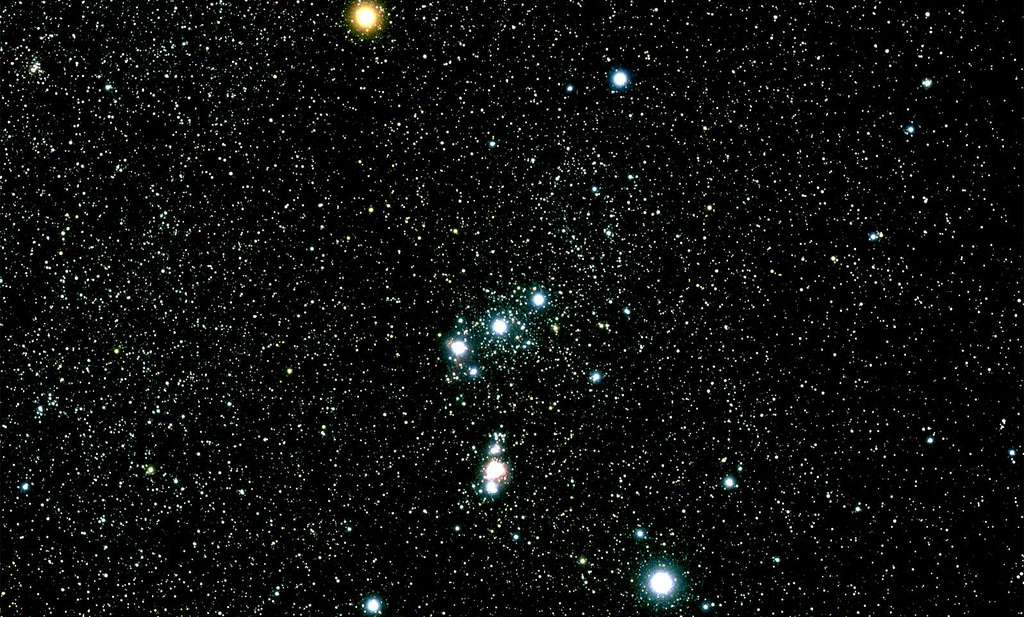
Constellation Orion, NASA,
Public Domain, atoday.org.

Writing on astronomytrek.com, Peter Christoforou, explained the proposition. According to Christoforou "Dr. Michael A. Rappengluck is well respected in academic circles, and has a solid grounding in both astronomy and the history of astronomy. In fact, Dr. Rappengluck holds an advanced degree in the History of Astronomy from the University of Munich, and he has served as the President of the Society of Archaeaoastronomy in Germany." (Christoforou 2018)

"According to research published by Dr. Rappengluck, the figure must be Orion, since the slim waist of the figure corresponds to the Belt of Orion, and the sword he sees hanging from the waist of the figure is easy to see in the real constellation. Moreover, Dr. Rappengluck is at some pains to point out that the figurines' left leg is somewhat shorter than the right leg, just as it is in the constellation. Therefore, the figure on the ivory fragment is Orion the Hunter." (Christoforou 2018) I feel I should take this opportunity to point out that the writer Peter Christoforou has gone out of his way to be fair to Rappenglueck, even if he is not convinced of the carving's identity as Orion (and I urge you to read his whole paper at the address below) he has given all the arguments, pro and con.

The usual arguments still apply, but in this case a couple of new ones come into play as well. First, thousands of bone, ivory, and antler carvings were recovered from Geißenklösterle Cave but this is the only one that portrays a constellation? To make this argument Christoforou pointed to a carving of a bison. "This figuring of a bison shows some simple bas-relief in addition to faint details like horns and a beard, despite the fact that it measures only 25.5mm x 14.5 mm x 6 mm, which is comparable to the dimensions of the human-like figure of the putative Orion star map. The original carving is housed in the Wurttemberg Landesmuseum, Stuttgart.
While the existence of this particular carving (the bison) does not prove anything beyond the fact that it shows exquisite workmanship, it is significant that neither Dr. Rappenglueck, nor any other archeaoastronomers have suggested that the figure represents the constellation Taurus, or any other constellation. Of course, this does not prove that the Orion carving is not a star map, but the point is that only one artifact from among the thousands recovered from the cave is taken to represent a constellation. By all accounts, this is rather strange considering the sheer amount of artifacts that could be taken as star maps, or representations of the objects/patterns in the night sky." (Christoforou 2018)

The other obvious problem is, of course, the sword that Rappenglueck sees hanging from the figure's belt, and that identifies him as Orion. Is it really like all the other known Paleolithic swords to be so convincing? Oh wait, what's that you say, there are no Paleolithic swords? What was I thinking of?

Another issue is the fertility connection that Rappenglueck imbues this carving with. Remember the 86 notches on the back of the carving? "The average length of human gestation is 280 days, or 40 weeks." (www.betterhealth.vic) Rappenglueck noted that if you subtract the 86 notches from the number of days in a year you have a number that is very close to the average length of modern human pregnancy. (The only references I have been able to find about the length of pregnancy in the Paleolithic period assume that it was the same as today).
"The reverse side of the Orion carving is dotted with 86 notches, which Dr. Rappanglueck claims is a "birth calendar". According to Dr. Rappenglueck, if one subtracts 86 from the number of days in a year (365), one arrives at the average human gestation period, which is around 279 days, or nine months, gave or take a few days either way. Nevertheless, this implies that the Aurignacian culture could count, that they knew how many days there were in a year, and that they understood and practiced basic arithmetic." (Christoforou 2018)

I am going to give them some benefit of the doubt here - I assume that the Aurignacian peoples could count. I find it inconceivable that they would have reached such cultural heights and overlooked counting. I even assume that they could understand and practice simple basic arithmetic. I am less convinced that they knew the number of days in a year - 12 moons, yes, but the actual number of days in a year, I don't know. This, however, makes no difference. What kind of pregnancy calculation is made by subtracting 86 days from the end of a year, when you don't know at what point the year started (when the pregnancy began)?

"Moreover, Dr. Rappenglueck also claims that the 86 notches on the carving represent the number of days that one of Orion's principal stars, Betelgeuse, is visible, thus forming a link between the sky gods and human fertility." (Christoforou 2018)

This last statement is particularly confusing because the truth is that Betelgeuse is visible all year except for June and July when they are in the sky during daylight hours. "In the Northern Hemisphere, beginning in January of each year, it can be seen rising in the east just after sunset. By mid-September to mid-March (best in mid-December), it is visible to virtually every inhabited region of the globe, except for a few research stations in Antarctica at latitudes south of 82˚. In May (moderate northern latitudes) or June (southern latitudes), the red supergiant can be seen briefly on the western horizon after sunset, reappearing again a few months later on the eastern horizon before sunrise. In the intermediate period (June-July) it is invisible to the naked eye (visible only with a telescope in daylight) - - . " (wikipedia.org/wiki/Betelgeuse)

All in all, this Orion figurine is the most egregious of Rappenglueck's claimed identifications of Paleolithic star maps, and I find it totally unbelievable.

NOTE: The pictures in this posting were retrieved from the internet with a search for public domain images. If they were not meant to be public domain please contact me and I will give full credit.

REFERENCES:

Christoforou, Peter
2018 Is the Ach Valley Tusk-fragment an Ancient Star Map?, March 2, 2018, https://www.astronomytrek.com/is-the-ach-valley-tusk-fragnebt-an-ancient-star-map/

https://en.wikipedia.org/wiki/Betelgeuse

https://en.wikipedia.org/wiki/Orion_(constellation)

https://www.betterhealth.vic.gov.au/health/healthyliving/baby-due-date

NASA

www.ancient-origins.net

www.astronomytrek.com

Saturday, October 20, 2018

PALEOLITHIC STAR CHARTS - THE NORTHERN CROWN IN EL CASTILLO?


Red paintings in El Castillo
Cave, Spain - Public Domain.

I continue my exploration of (supposed) Paleolithic Star Charts with what has been called a diagram of the Northern Crown constellation in El Castillo Cave, in Spain. El Castillo is the current holder of the title for the oldest art in Europe with recent dates for red painted elements; Red circle: 40,800 BP, Red Hand: 37,300 BP (David 2017:146) I wrote about these dates, the oldest currently known for Europe, on September 20, 2014, in a column titled Uranium Isotope Dating Reveals Perhaps The Oldest Cave Art In Europe, on RockArtBlog. (Faris 2014)

Diagram of the "frieze of hands"
with the arc of dots on the right
side. Public domain.

A semicircle of dots on the right side of the Panel de las Manos has been identified by Dr. Michael Rappenglueck as another Paleolithic Star Chart, this one the Corona Borealis, or Northern Crown. One of those who had taken him seriously; Kathleen Flanagan Rollins, wrote in her blog Misfits and Heroes; "After visiting El Castillo and looking at the panel in question, I have to admit I was wrong. It's not a clear semi-circle of start but more like a full circle. I suppose that's the danger of working from a diagram rather than the real thing." (Rollins 2015) This does not seem to me to be an effective argument against the idea of this painting as Corona Borealis as there are plenty of other stars around the constellation that one can decide could be included in the constellation to make it a rough, but full, circle. I will give this one to Rappenglueck; arc, or circle - I don't see that it matters.

Close-up drawing of the arc of
dots identified as Corona borealis.
Public domain.

My objections to this theory are the same as my objections to Rappenglueck's other identified Paleolithic Star Charts. We cannot know whether Paleolithic peoples of Europe even recognized constellations or had the concept of arrangements of stars representing shapes in the sky. Even if they did they certainly would not have identified this grouping as a crown, the concept of a crown was doubtless millennia in mankind's future. Also, I still am not convinced that the people would have gone deep underground to paint star charts when all they had to do to see them was look up at night. I get the "secret knowledge" argument, I just don't agree with it. I am not saying that this theory is not possible, I am just saying that I do not see anywhere near enough evidence to make such leaps to conclusions. I see too many possible arguments against, and too few arguments in favor.


Modern star diagram of Corona borealis.
Wikimedia. Public domain.

NOTE: Some images in this posting were retrieved from the internet with a search for public domain photographs. If any of these images are not intended to be public domain, I apologize, and will happily provide the picture credits if the owner will contact me with them. For further information on these reports you should read the originals at the sites listed below.

REFERENCES:

David, Bruno
2017 Cave Art, Thames & Hudson, London.

Faris, Peter,
2014 Uranium Isotope Dating Reveals Perhaps The Oldest Cave Art In Europe, http://rockartblog.blogspot.com/2014/09/uranium-isotope-dating-reveals-perhaps.html

Rollins, Kathleen Flanagan,
2015 El Castillo: Wonders and Questions, 12 September 2015, https://misfitsandheroes.wordpress.com/tag/northern-crown-in-rock-art/


Saturday, August 18, 2018

A POSSIBLE RIO GRANDE GORGE METEOR PETROGLYPH:


Petroglyph panel, on the Trail to
Manby Hot Springs, Rio Grande
Gorge, outside of Taos, New Mexico.
Photograph Jerry Hansen.


Arrow pointing out possible
meteor symbol.

I have, on a number of past occasions, speculated on the subject of meteor portrayals in rock art. On May 6, 2009, I posted "When The Stars Fell." On January 18, 2013, I posted "Meteorites." On February 16, 2013, I posted "Meteorites In Rock Art - Continued?" And, on January 17, 2015, I posted "Meteorites In Rock Art - A Possible Portrayal." In these, I made the assumption that something as impressive as a major meteor storm or meteor fall would have been recorded in rock art. Indeed, there are such records in other mediums such as winter counts, so why not in rock art. Now, I have received photos from Jerry Hansen in New Mexico, in the Rio Grande River Gorge southwest of Arroyo Hondo that he suggests as a possible meteor portrayal.


Hansen's interpretation of the
Rio Grande Panel.
Photograph Jerry Hansen.


Tiwa/Tewa Constellations and
Stars. Dorcas, 1997. 

I have not visited this site myself so I know nothing about it directly, but if the location is correct we may be able to deduce some things about it. First, from the location I am assuming that these petroglyphs were probably made by the northern Tiwa or the Tewa speaking Pueblos of the North Rio Grande area. Second, if that symbol does indeed represent a meteorite, the other petroglyphs on the panel likely represent a sky chart showing the constellations of the Tewa or Tiwa people that the meteorite appeared in. Miller (1997) lists many different names for these constellations (and asterisms). Pretty much each group uses a different name for many of them. One that most of the people agree on, however, is Turkey Track, and that appears in the left side of the panel. The other figures on the panel may or may not represent Tiwa/Tewa constellations, but if some correlations could be made here then the possibility that the image in question represents a meteorite would be fairly strong.

So, where do we go from here? Perhaps some anthropology student searching for a thesis project would like to take over and dig into this.


REFERENCE:

Miller, Dorcas S.
1997 Stars of the First People: Native American Star Myths and Constellations, Pruett Publishing, Boulder, Colorado.

Saturday, August 11, 2018

ANOTHER SUPPOSED STAR MAP PAINTED IN LASCAUX CAVE, FRANCE - THE SUMMER TRIANGLE:


Dying Man panel, Lascaux Cave,
France. Public Domain.

Another supposed star map painted in Lascaux Cave, France, is found at the bottom of the shaft in Lascaux Cave. It is the panel known as the "Dying Man." On April 28, 2009, I wrote here in RockArtBlog WHY DO WE BELIEVE THIS? #2, THE DYING MAN IN LASCAUX CAVE. Then on July 9, 2011, I wrote THE "S-WORD", SHAMANISM - OR, THE DYING MAN IN LASCAUX REVISITED. In both of these I discussed possible meanings of that enigmatic painted panel. At the time I wrote these I had not run across the theories of Dr. Michael Rappenglueck. Not only has Dr. Rappenglueck identified the great bull panel of Lascaux as a star map of the Pleiades and Taurus, the Dying Man panel has been identified as a representation of the asterism known as the Summer Triangle.

I wrote about my doubts in Rappengluck's identification of the bull panel as the constellation Taurus on August 4, 2018, in my column titled ARE LASCAUX CAVE PAINTINGS ENCODED PALEOLITHIC STAR CHARTS? This week I am expressing even more doubt with the identification of the Dying Man panel.


Summer Triangle outlined,
Dying Man panel, Lascaux
Cave, France. treeofvisions.
files.wordpress.com.
Public Domain.

"According to Dr. Rappengluck, these outlines form a map of the sky with the eyes of the bull, birdman, and bird representing the three prominent stars Vega, Deneb, and Altair. Together these stars are popularly known as the Summer Triangle and are among the brightest objects that can be picked out high overhead during the middle months of the northern summer. Around 17,000 years ago, this region of sky would never have set below the horizon and would have been especially prominent at the start of spring. "It is a map of the prehistoric cosmos," Dr. Rappengluck told BBC News Online. "It was their sky, full of animals and spirit guides."" (Whitehouse 2000)


Summer Triangle star chart,
ualr.ed, Public Domain.

This identification is even shakier than the previous one because he cannot point to the subject matter to say that it supports his identification. He is merely adopting three features of the panel and declaring that they represent the Summer Triangle, but at least that gets around my argument that we cannot know whether Paleolithic peoples of Europe recognized constellations as animals in the sky, and even if they did we cannot know what animals they believed they saw.


Summer Triangle.
wikimedia.org,
Public Domain.

I still am not convinced that the people would have gone deep underground to paint star charts when all they had to do to see them was look up at night. I get the "secret knowledge" argument, I just don't agree with it.

And why their eyes, why not their assholes. OK, I'll admit that the spacing is different and that is even less likely, but I think you ought to get my point. Rappenglueck is basing this designation on way too many assumptions, with no proof for any of them. And if there is anything we don't need in the study of rock art it is these wild theories with no proof backing them. The next thing we know someone will come out with theories of rock art being produced by ancient aliens. Wait a minute, that has already been done too.

NOTE: Some images in this posting were retrieved from the internet with a search for public domain photographs. If any of these images are not intended to be public domain, I apologize, and will happily provide the picture credits if the owner will contact me with them. For further information on this report you should read the original at the site listed below.


REFERENCE:

Whitehouse, David
2000 Ice Age Star Map Discovered, 9 August 2000, http://news.bbc.co.uk/2/he/science/nature/871930.stm

Saturday, August 4, 2018

ARE LASCAUX CAVE PAINTINGS ENCODED PALEOLITHIC STAR CHARTS?


Lascaux Cave, France, showing the
supposed star chart panel of Taurus
the Bull, www.twiggietruth.com,
Public Domain. 

Another shaky theory has come to my attention recently. It is a reincarnation of the idea that the paintings in Lascaux cave contain encoded star charts.

"In recent years, new research has suggested that the Lascaux paintings may incorporate prehistoric star charts. Dr. Michael Rappengluck of the University of Munich argued that some of the non-figurative dot clusters and dots within some of the figurative images correlate with the constellations of Taurus, The Pleiades and the grouping known as the summer triangle." (ancient-wisdom.com)


Lascaux Cave, France, showing the
supposed star chart panel of Taurus
the Bull, clarensnews.co.za,
Public Domain.

"Near to the entrance of the Lascaux cave complex is a magnificent painting of a bull. Hanging over its shoulder is what appears (to us) to be a map of the Pleiades, the cluster of stars sometimes called the Seven Sisters. Inside the bull painting, there are also indications of spots that may be a representation of other stars found in that region of the sky. Today, this region forms part of the constellation of Taurus the bull, with the remarkable suggestion of a direct transfer of information for over 17,000 years." (ancient-wisdom.com)


Lascaux Cave, France, showing the
supposed star chart panel of Taurus
the Bull, truth-zone.net,
Public Domain.

My first problem with this idea is that we have no idea whether people at this stage of cultural development had the concept of the stars making pictures of large animals in the sky (I am not saying they didn't, I am just saying we don't know either way). Although Rappengluck might assume it, there is no proof. We do know that many thousands of years later the Sumerians had that concept, they left us written records, we just do not know how much farther back it went.

"The history of astronomy - begins with the Sumerians who developed the earliest writing system - known as cuneiform - around 3500-3200 BC. The Sumerians developed a form of astronomy that had an important influence on the sophisticated astronomy of the Babylonians. Babylonian astronomy focused on a select group of stars and constellations known as ziqpu stars. During the 8th and 7th centuries BC, Babylonian astronomers developed a new empirical approach to astronomy. They began studying philosophy dealing with the ideal nature of the universe and began employing an internal logic within their predictive planetary systems." (wikipedia)


Lascaux Cave, France, showing the
supposed star chart panel of Taurus
the Bull, thehiddenrecords.com,
Public Domain.

My second problem with this idea is the assumption that their constellations would have been the same as ours. Yes, Rappenglueck apparently can find enough spots and dots in the paintings of Lascaux to roughly approximate some of our historically dedicated constellations. And yes, he can overlay our star pattern for the constellation that we designate as Taurus, the bull, over the forepart of a painted aurochs, but who is to say that the painters of Lascaux thought of those stars as making a bull at all. Perhaps they were part of a great constellation they recognized as a mammoth, a wooly rhinoceros, or maybe the Great Ground Squirrel. Perhaps that bull is just a picture of a bull after all.


A modern star chart showing
Taurus, Orion, and the Pleiades.

And third, I am not comfortable with the concept of people heading underground to study the constellations in the sky. Why aren't they just out looking up at the sky? I get the whole "secret knowledge" thing, I just don't agree. I think that this explanation is way overused. It is trotted out to explain almost anything that there is not an obvious explanation for - and again there is no proof.

Rappenglueck certainly did not originate these theories, fringie elements have propounded this for some time, he has just tried to make them academically respectable. In all fairness, I feel I should say that this might even be correct, but even if it is there is not yet enough proof to make these claims. I can understand why the press jumps on these kinds of theories - secret knowledge of the ancients - sexy stuff. But why do scholars go along with this?

NOTE: Images in this posting were retrieved from the internet with a search for public domain photographs. If any of these images are not intended to be public domain, I apologize, and will happily provide the picture credits if the owner will contact me with them. For further information on these reports you should read the originals at the sites listed below.

REFERENCES:

https://www.ancient-wisdom.com/francelascaux.htm

https://en.wikipedia.org/wiki/Babylonian_astronomy#Old_Babylonian_astronomy

Saturday, October 7, 2017

ZORATS KARER - AN AMAZING SITE IN ARMENIA:


Zorats Karer (Karahunj), Armenia,
Pinterest, Public domain.

A site in Armenia with many standing stones, Zorats Karer (also called Karahunj or Carahunge) is much debated. Some theories call it an astronomical observatory while many other purposes have also been proposed including defensive, and a cattle market. The site is found at a "latitude of 39 34' and longitude of 46 01' on the mountain plateau having (an) altitude (of) 1770 m. and occupies a territory of about 7 hectare(s) on the left side of the Dar river canyon, the tributary of the river Vorotan (at 2 km). It is located on a rocky promontory near Sisian." (Wikipedia)


Interior of Zorats Karer,
www.ancient-origins.net,
Public domain.

"The first scholarly account of Zorats Karer took place in 1935 by ethnographer Stepan Lisitsian, who alleged that it once functioned as a station for holding animals. Later, in the 1950s, Marus Hasratyan discovered a set of 11th to 9th BCE burial chambers.  But the first investigation which garnered international attention to the complex was that of Soviet archaeologist Onnik Khnkikyan, who claimed in 1984 that the 223 megalithic stones in the complex may have been used, not for animal husbandry, but instead for prehistoric stargazing. He believed the holes on the stones, which are two inches in diameter and run up to twenty inches deep, may have been used as early telescopes for looking out into the distance or at the sky." (Vann 2017) I am assuming that the association of the stones with pastoralist and their animals would have been based upon some idea such as the stones with holes are hitching posts to tie the animals up to. The prehistoric stargazing is certainly destined to be a much more popular theory at the present time given current enthusiasm and overemphasis on archaeoastronomy.


Zorats Karer (Karahunj),
WordPress.com,
Public domain.

"In recent years, to the dismay of local scientists, the monoliths have garnered the interest of the international community after some pre-emptive research emerged drawing comparisons between the astronomical implications of Zorats Karer and that of the famous Stonehenge monument in England. Many touristic outlets responded to the comparison by branding Zorats Karer colloquially as the 'Armenian Stongehenge' and the resulting debate between the scientific community and popular culture has been a fierce one." (Vann 2017)


Close-up view of a drilled stone,
Dreamstime.com,
Public domain.

The problem in the archaeoastronomical interpretation comes with identifying the holes in the stones as sights for viewing. If you are close enough to a 2" hole to see much at all though it your field of view is going to be 20 to 30 degrees wide, not a very precise measuring tool. I have also been unable to find any reports that mention holes in adjacent rocks lining up which would have actually been a much more precise sighting device. In the photo above you can see a monolith through the hole as if they were a rifle's peep sight and front sight, but they line up on the distant hillside, not anything on the horizon or sky. Obviously not a marker.


View through a drilled stone,
Dreamstime.com,
Public domain.

"In 1994, Zorats Karer was extensively analyzed by Professor Paris Herouni, a member of the Armenian National Academy of Science and President of the Radio Physics Research Institute in Yerevan. His expeditions revealed a great deal of fascinating information about the site. First of all, his team counted 223 stones, of which 84 were found to have holes." (Klimczak 2016) (the holes are, however, especially fascinating.)


Map of Zorats Karer,
Wikipedia.
Public domain.

Klimczak continued that "a number of researchers concluded that the monument is at least 7,500-years-old, but possibly much more. It is believed to have been created for ritual reasons and the need to understand the movements of the sun, moon, and stars. The people who created (it) connected their beliefs with the early science of astronomy. it seems that the main functions of the observatory, which was also a temple, were to serve in the cult of the Sun god of early Armenians, to provide protection through cultivating the Armenian god of science, to serve as a school, and to function as an observatory." (Klimczak 2016)


In other words, we don't have any idea exactly what Zorats Karer was intended for. Also, none of the reports I have been able to find explain how the daring was arrived at. Probably, as in so many other cases, the uses changed over time with the beliefs and interests of the inhabitants of the area, and maybe all of the suggestions have a germ of truth in them. In any case, it looks like an absolutely fascinating site, and deserves much more study. The truth must be in there somewhere.

NOTE: Images in this posting were retrieved from the internet after a search for public domain photographs. If any of these images are not intended to be public domain, I apologize, and will happily provide the picture credits if the owner will contact me with them. For further information on these reports you should read the originals at the sites listed below.

REFERENCES:

Klimczak, Natalia
2016 Armenian Stonehenge: Incredible History of the 7,500-Year-Old Observatory of Zorats Karer, http://www.ancient-origins.net/ancient-places-asia/armenian-stonehenge-incredible-history-7500-year-old-observatory-zorats-karer-021027


Vann, Karen
2017 Unraveling the Mystery of the "Armenian Stonehenge", http://www.smithsonianmag.com/travel/unraveling-mystery-armenian-stonehenge-180964207/


https://en.wikipedia.org/wiki/Zorats-Karer