Saturday, October 29, 2022

8,000 YEAR OLD DEPICTIONS OF DOMESTIC CANINES:

Leashed dogs and hunter, petroglyphs, Shuwaymis, Saudi Arabia. Internet photograph, public domain.

A team of archaeologists from the Max Planck Institute and Saudi Arabian Commission for Tourism and National Heritage has been recording rock art in Northwestern Saudi Arabia.

One fascinating category of images consists of hunting scenes in which bow and arrow armed humans are accompanied by dogs, some of which seem to have lines connecting them to the hunters – a leash? They also believe that according to their estimated age of these petroglyphs that they represent the oldest known portrayals of canines, at least domesticated canines.

Dogs and hunters, petroglyphs, Shuwaymis, Saudi Arabia. Internet photograph, public domain.

“The hunting scene comes from Shuwaymis, a hilly region of northwestern Saudi Arabia where seasonal rains once formed rivers and supported pockets of dense vegetation. For the past 3 years, Maria Gaugnin, and archaeologist at the Max Planck Institute for the Science of Human History in Jena, Germany – in partnership with the Saudi Commission for Tourism & National Heritage – has helped catalog more than 1400 rock art panels containing nearly 7000 animals and humans at Shuwaymis and Jubba, a more open vista about 200 kilometers north that was once dotted with lakes.” (Grimm 2017)

Climatic warming has severely dried this area to what is now more like arid desert, but in the past it was wetter and with more vegetation to encourage animal life.

Aurochs hunt, Shuwaymis, Saudi Arabia. Internet image, public domain.

“Starting about 10,000 years ago, hunter-gatherers entered – or perhaps returned to – the region. What appear to be the oldest images are thought to date to this time and depict curvy women. Then about 7000 to 8000 years ago, people here became herders, based on livestock bones found at Jubbah: that’s likely when pictures of cattle, sheep, and goats began to dominate the images. In between – carved on top of the women and under the livestock – are the early hunting dogs: 156 at Shuwaymis and 193 at Jubbah. All are medium-sized, with pricked up ears, short snouts, and curled tails – hallmarks of domestic canines. In some scenes, the dogs face off against wild donkeys. In others they bite the necks and bellies of ibexes and gazelles. And in many, they are tethered to a human armed with a bow and arrow.” (Grimm 2017) So, in a considerable array of canine images, some few are connected to human figures by lines or tethers which are considered to be possible leashes while most are not.

Hunter with two leashed dogs and a pack of unleashed dogs. Photograph by M. Guagnin.

 “We already knew that pre-Neolithic humans used domesticated dogs for hunting purposes, but details about how exactly they went about this have remained unclear. The 147 hunting scenes the researchers have been studiously documenting at sites in Shuwaymis and Jubbah, in northwestern Saudi Arabia, show a range of possible roles. A paper detailing the research was published in the Journal of Anthropological Archaeology. ‘When (corresponding author Maria Guagnin) came to me with the rock art photos and asked me if they meant anything, I about lost my mind,’ co-author Angela Perri, who studies animal archaeology at the Max Planck Institute for Evolutionary Archaeology in Leipzig, Germany, told Science Magazine. ‘A million bones won’t tell me what these images are telling me,’ she says. ‘It’s the closest thing you’re going to get to a YouTube video.’” (Medrano 2017)

No dating is available for these ancient petroglyphs so the researchers had to estimate their potential ages by looking at the stratigraphy of the rock art itself (the sequence in which the images were carved). “The researchers couldn’t directly date the images, but based on the sequence of carving, the weathering of the rock, and the timing of the switch to pastoralism, ‘The dog art is at least 8000 to 9000 years old,’ Guagnin says. That may edge out depictions of dogs previously labeled the oldest, paintings on Iranian pottery dated to at most 8000 years ago.” (Grimm 2017)

“Even if the art is younger than Guagnin and her colleagues think, the leashes are by far the oldest on record. Until now, the earliest evidence for such restraints came from a wall painting in Egypt dated to about 5500 years ago, Perri says. The Arabian hunters may have used the leashes to keep valuable scent dogs close and protected, she says, or to train new dogs. Leashing dogs to the hunter’s waist may have freed his hands for the bow and arrow.” (Grimm 2017) Here, the writer is implying that the hunters used two types of dogs, or had dogs fulfilling two roles. The “scent dogs” would be the ones with the most sensitive noses for tracking by scent, while the other “sight hounds” would be the pack of visual hunters who handled the pursuit and cornering of the game. Some game animals could actually be taken down by the pack while larger game such as aurochs could be cornered until the hunters came up with weapons to end the confrontation. Grimm is also implying that the “scent dogs,” being more valuable, were the ones on the leash while the pack hounds were free to pursue, corner, and possibly be injured by large game.

Wild Ass hunt, Shuwaymis, Saudi Arabia. Internet pnotograph, public domain.

“Dogs can realize a decrease in search costs and an increase in prey encounter rates by flushing and finding animals. These characteristics may be especially important with pedestrian hunts where pray resources that are highly dispersed or have low densities, are cryptic or fossorial, and/or occupy biomes with heavy vegetation and rugged terrain. Reductions in search costs become less beneficial with prey that use habitual paths or runways or that are highly predictable in location and where hunting require(s) stealth and ambush strategies and the use of some stationary technology (traps, snares). Dogs can also reduce the handling costs association with prey acquisition by distracting or baying dangerous animals, pursuing wounded prey and finding carcasses of animals that have been killed. The latter characteristics are especially advantageous with the use of certain kinds of dispatch technology that do not always immediately kill the animals, such as poisoned arrows or in heavily vegetated areas and rugged terrain where locating dead animals is difficult. The ability of dogs to chase and locate a wounded and dying animal or the carcass of one that has died from its wounds is a critical factor that reduces the chances of hunting failure and improves success.” (Lupo 2017) While all of these factors are germane, Lupo overlooks the value of the “scent dogs” in following a game animals trail in situations where visual clues are absent. This is also one method in which the dog can locate the “wounded and dying animal” mentioned, by following the scent.

Canaan Dog, Wikipedia. Photograph by Hodowla Samorodok Hanaana.

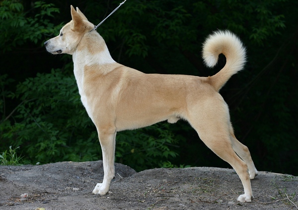
“The dogs look a lot like today’s Canaan dog, says Perri, a largely feral breed that roams the deserts of the Middle East. That could indicate that these ancient people bred dogs that had already adapted to hunting in the desert, the team reports in the Journal of Anthropological Archaeology. Or people may even have independently domesticated these dogs from the Arabian wolf long after dogs were domesticated elsewhere, which likely happened sometime between 15,000 and 30,000 years ago.” (Grimm 2017) The existence of the Canaan dog in Arabia is known from at least 9000 years ago. “The Canaan Dog is the oldest breed of pariah dog still existing and abundant across the Middle East. It can be found in Israel, Palestine, Jordan, Lebanon and the Sinai Peninsula, and these, or dogs nearly identical were also found in Iraq and Syria over 9000 years ago.” (Wikipedia)

The origins of the domesticated dog have been much in the news (at least the scientific news) of late and that question has not yet been settled, but, for now, it appears that we do know the first rock art picturing domesticated dogs.


NOTE: Some images in this posting were retrieved from the internet with a search for public domain photographs. If any of these images are not intended to be public domain, I apologize, and will happily provide the picture credits if the owner will contact me with them. For further information on these reports you should read the original reports at the sites listed below.

REFERENCES:

Grimm, David, 2017, These may be the world’s first images of dogs – and they’re wearing leashes, 16 November 2017, https://www.science.org

Lupo, Karen D., 2017, When and where do dogs improve hunting productivity? The empirical record and some implications for early Upper Paleolithic prey acquisition, Journal of Anthropological Archaeology 47 (2017) 139-151.

Sunday, October 23, 2022

DANIGALA MOUNTAIN’S NEOLITHIC PETROGLYPHS:

Danigala Circular Rock, Sri Lanka. Internet photograph, public domain.

Danigala Circular Rock is an inselberg (an isolated mountain rising above a plain) consisting of Precambrian rock in Sri Lanka. A large number of deeply grooved petroglyphs have been discovered in caves and shelters in its cliffs. With estimated dates of 5,000 to 3,500 BP “The main anthropomorphic figures at Danigela do not appear to be carved with pure of traditional beliefs and iconography of the gods worshipped in temples. Instead, they appear to be reflective of a ritual system built around beneficial ancestral spirits who could be approached and appeased in exchange for protection from evil spirits, diseases, and calamities. The petroglyphs might also represent deities of the Vedda people at Girigama as symbols of ritualistic offerings.” (Sumanarathna 2020:54) Girigama is an ancient local name for the Danigala area.

"Bind code of wounded anthropomorph and giant maribou stork." Photograph by Aravinda Ravibhanu.

“The petroglyphs might also represent deities of the Vedda people at Girigama as symbols of ritualistic offerings. Many of the symbols carved adjoining the main figure has (sp) a votive value, some possibly denoting death and the transmigration of the soul into the afterlife. Other symbols include anthropomorphic representation of animals. These animals were totems of the Girigama Vedda or Danigala Vedda.” (Sumanarathna 2020:54)

Vedda is the designation of the original aboriginal peoples of Sri Lanka and their remaining minority descendants. (Encyclopaedia Britannica Online)

Photograph by Aravinda Ravibhanu.

“Anthropomorphic figures of Danigala Chithra Lena Petroglyphs, though linear in delineation, are quite articulate in execution. The outline of the figures appears to have been first outlined and subsequently etched or grooved out afterwards. Most of the figures are generally made using single grooved lines, though figures with grooved double lines were also encountered.” (Sumanarathna 2020:54) Most of the petroglyphs consist of deep grooves with the outlines infilled with patterning.

"Left side wall, crooked bind rune anthropomorph." Photograph by Aravinda Ravibhanu.

Sumanarathna et al. refer to a number of the petroglyphs at Danigela as “bind runes.” This terminology is somewhat incorrect. “A bind rune or bindrune (Icelandic: bandrun) is a Migration Period Germanic ligature of two or more runes. They are extremely rare in Viking Age inscriptions, but are common in earlier (Proto-Norse) and later (Medieval) inscriptions.” (Wikipedia-Bind Rune) If they actually mean to say that some of the petroglyphs are combinations of two symbols to combine their meanings it would really be more appropriate to designate them as ligatures. “In writing and typography, a ligature occurs where two or more graphemes or letters are joined to for a single glyph.” (Wikipedia – Ligature)


"Left side wall anthropomorph, worshipping ladder figure, spiritual activities." Photograph by Aravinda Ravibhanu.

Sumanarathna et al. seemingly use the term to refer to a combination of symbols identified from other locations into a single symbol seen at Danigala, and assume it represents a form of writing. According to Merriam-Webster Online Dictionary, ligature has three different meanings. First, it is the combining of symbols in a form of writing as outlined above. Second, a ligature is a binding of something, i.e. a surgeon’s knot closing a wound (which is where the phrase “bind rune” surely came from. And third, a compound note in mensural notation, indicating a group of musical notes to be sung to one syllable.

"Left side wall anthropomorphic figures with bows and arrows." Photograph by Aravinda Ravibhanu.

As the petroglyphs published from Danigala are mostly identified as anthropomorphs and/or zoomorphs I don’t agree that the term bind rune to describe them is accurate in this case. Perhaps the authors of the study are implying that the anthropomorphs and/or zoomorphs are combined into a single symbol of some sort, but since they are definitely not runic the term bind rune is still not accurate. Indeed, I also am uncomfortable with using the term ligature for composite images of anthropomorphs and/or zoomorphs. Perhaps the term therianthrope would be more accurate. I cannot really see most of the images they have identified in the illustrations in their paper. Perhaps standing in front of the panel and taking it all in at once would be illuminating, but since I am not likely to be in Sri Lanka any time soon I will have to stick to their illustrations. It is, however, and intriguing place with some very impressive petroglyphs.

NOTE 1: The photograph captions in quotation marks are taken from Sumanarathna Avavinda Ravibhanu, et al., 2020.

NOTE 2: Some images in this posting were retrieved from the internet with a search for public domain photographs. If any of these images are not intended to be public domain, I apologize, and will happily provide the picture credits if the owner will contact me with them. For further information on these reports you should read the original reports at the sites listed below.

REFERENCES:

Cowie, Ashley, 2020, Exo-Geologist Reveals Neolithic Petroglyphs In “Alien Mountain” Caves, 11 September 2020, https://www.ancient-origins.net, accessed 13 August 2022.

Encyclopaedia Britannica Online, undated, Vedda People, edited and updated by Kenneth Pletcher,https://www.britannica.com/topic/Vedda

Merriam-Webster Dictionary (online), undated, Ligature, https://www.merriam-webster.com/dictionary/ligature, accessed 9 September 2022.

Sumanarathna, Avavinda Ravibhanu, et al., 2020, The First Record of The Archeoastronomical Bind Rune Associated with Petroglyphs in Danigala Circular Rock, Sri Lanka, Trivalent Journal of Archaeology, Vol. 1, Issue 2, DOI: http://doi.org/10.4038/tjata.v1i2.37

The Jerker, 2022, The miraculous Danigala Inselberg Of Sri-Lanka, 6 February 2022,https://thejerker.com, accessed 21 August 2022.

Wikipedia, Bind Rune, https://en.wikipedia.org/wiki/Bind_rune, accessed 22 August 2022.


Wikipedia, Ligature (writing), https://en.wikipedia.org/wiki/Ligature_(writing), accessed 8 September 2022

Saturday, October 15, 2022

ROCK ART AND CLIMATE CHANGE:


Humans live within, and are molded by, their environment, from cultural effects to actual evolutionary traits we are products of the world we live in. This influences every aspect of our lives, from technology to the arts. One of the most powerful factors of the environment on us is the climate, and “when considered over a period of time, art may also be an indicator of changes in climate. This assumes some importance in the light of the current debate over long-term climate change. According to the balance of current scientific opinion, climate change is occurring on this planet, and human activities are contributing to it.” (McCouat 2019)

Wooly mammoths, horse, wooly rhinocerus, Kapova Cave, Russia. Internet photograph, public domain.

Wooly mammoth, ibexes, Grotte de Rouffignac, France. Internet photograph, public domain.

When we look at art from the ancient past with the effects of climate in mind we can begin to analyze the effects of climate on the variations seen in the art. “How much can we learn from ancient cave and rock art about climate variations in the past? Even in the absence of direct depictions, we can certainly get some indirect evidence from features such as the types of animals (particularly large mammals) that are shown. To take an obvious example, if paintings of reindeer or woolly mammoth appear regularly at a site, it is a fair guess that conditions were extremely cold at the time, where giraffes would indicate a much warmer environment.” (McCouat 2019)

Giraffe petroglyph, Algeria. Internet photograph, public domain.

This is an extreme example, but the principle is a good one. In the magnificent painted caves of Europe, decorated with so much great realistic art of animals, variations in the type of fauna portrayed might well indicate climatic shifts from glacial conditions to later post-glacial warming climates. How much can we learn from ancient cave and rock art about climate variations in the past? Even in the absence of direct depictions, we can certainly get some indirect evidence from features such as the type of animals (particularly large mammals) that are shown.

Heyd and Lenssen-Erz (2015) propose “the consideration of associations between, on the one hand, important changes or variations in climate, and, on the other, a) the appearance or disappearance of particular motifs, b) significant increases or decreases in variability of motifs or styles over a certain territory, c) over time, the production of rock art, and the discontinuation of such production, in areas that in principle are suitable for such production in terms of materials (wall space, painting or engraving surfaces and materials), and d) the utilization of particular motifs in time periods in which their use would seem surprising, given the actual environmental conditions that prevailed during the production of the art.” (Heyd and Lenssen-Erz 2015:265)

Exfoliating pictograph, Sulawesi, Indonesia. Internet photograph, public domain.

Other effects of climate are on the survival of the rock art itself. On 5 June 2021 I posted a column titled “THE EFFECTS OF CLIMATE CHANGE ON THE PLEISTOCENE ROCK ART OF SULAWESI” reporting on a study which found that changing climatic conditions were leading to the destruction of some of the world’s oldest rock art by exfoliation (Faris 2021, Huntley et al. 2021).

Kiva Point, Ute Mountain Tribal Park, Montezuma County, Colorado. Photograph Peter Faris, June 1981.

Kiva Point, Ute Mountain Tribal Park, Montezuma County, Colorado. Photograph Peter Faris, June 1981.

Closer to home, in the American southwest, the locations of early puebloan rock art panels was influenced by climatic conditions. Bellorado and Anderson found that the early Puebloan inhabitants of the Eastern Mesa Verde (EMV) area resided in different parts of the environment depending upon climatic conditions, which would be reflected in where rock art is located. “Throughout the Ancestral Puebloan occupation of the EMV region, changes in temperature regimes appear to have been the most significant influence on demographic movements of farming societies at several key points in time. Relative drought severity within the sub-regions of the northern Southwest also played an important role in ancient farmers’ decisions to stay in an area or move to another location that was perceived to have the potential to be farmed with greater success. This pattern demonstrates that farmers in the EMV area had long-standing, reliable, and probably quite formal subsistence strategies that included periodic movements from lowland to uplands (and back) in response to climatic changes.” (Bellorado and Anderson 2013: 406)

Cosquer Cave, France. Photograph Henri Gaspar.

Cosquer Cave, France. Photograph franceinfo.fr.

Another aspect of climate’s effect on the location of rock art is seen in rock art that has been submerged as a result of climate change. Between 9 January 2021 and 30 January 2021, I posted a series of four columns about underwater examples of rock art, some of which are the result of sea level rise because of climate change. Some of the examples in those columns were based upon a 2014 paper by Sachin Kr. Tiwary titled “UNDERWATER ROCK ART: IN GLOBAL CONTEXT.” In that paper Tiwary wrote about perhaps the most famous rock art site affected by climate change, Cosquer Cave. Cosquer Cave is a Paleolithic painted cave that was near sea level when painted but is now underwater because of sea level rise after the melting of the glaciers. “In July 1991 Dr. Jean Clottes, and English teacher (Honorary President of the French Prehistoric Society, Scientific Advisor for Prehistoric Art, Director of Prehistoric Antiquities) and a deep sea diver Henri Cosquer discovered paintings and engravings in a cave beneath the sea near Marseilles (France) on the Mediterranean. The gallery slopes up for about 360 feet underwater before reaching a huge chamber that partly remained above the sea where many prehistoric paintings and engravings are preserved on the walls as well as remains on the ground (charcoal, a few flint tools).This is the only painted cave in the world with an entrance below present-day sea level where cave art has been preserved from the flooding that occurred when the seas rose after the end of the last glaciations. Between 1991 and 2002 a number of dives were organized with the participation of Dr. Jean Courtin, who is professional archaeologist cum diver and Dr. Jean Clottes. The extraordinary location of the cave entrance is due to the rise of the sea level after the end of the last glaciations and the melting of the thick ice caps. The walls of all passages and chambers under the water have been corroded and no painting or engraving has been preserved. The rock art discovered is located in the upper chambers that have remained above the sea. About 180 animal figures have been registered, as well as many dozens of diverse geometric signs, 1000 finger drawings, 65 hand stencils and a strange image of a ‘killed’ man has been noticed.” (Tiwary 2014)

In the above examples we have seen that the effects of climate change can have a strong influence on rock art, from its content and its location to its ultimate survival. Perhaps if we change our perspective and look from the rock art back toward the climate we can find it illuminating on a number of levels. For instance the location of rock art may point to areas of residence or other usages, and content such as animals portrayed may suggest dating periods to investigate. In any event, as we change the world around us we should not be surprised at the side effects that pop up.


NOTE 1: See Sachin Tirwary’s paper below for many other examples of rock art sites that have been, or are becoming, inundated by sea level rise.

NOTE 2: Some images in this posting were retrieved from the internet with a search for public domain photographs. If any of these images are not intended to be public domain, I apologize, and will happily provide the picture credits if the owner will contact me with them. For further information on these reports you should read the original reports at the sites listed below.


REFERENCES:

Bellorado, Benjamin A., and Kirk C. Anderson, 2013, Early Pueblo Responses to Climate Variability: Farming Traditions, Land Tenure, and Social Power in the Eastern Mesa Verde Region, KIVA: Journal of Southwestern Anthropology and History, Vol. 78, No. 4, pp. 377-416, Summer 2013, Arizona Archaeological and Historical Society.

Faris, Peter, 2021, The Effects of Climate Change on the Pleistocene Rock Art of Sulawesi, 5 June 2021, https://rockartblog.blogspot.com

Heyd, Thomas, and Tilman Lenssen-Erz, 2015, Art, Rock Art and Climate Change, https://www.researchgate.net/publication/285356507

Huntley, J., Aubert, M., Oktaviana, A.A. et al., 2021, The Effects of Climate Change on the Pleistocene Rock Art of Sulawesi, Science Reports 11, 9833 (2021), https://doi.org/10.1038/s41598-921987923-3

McCouat, Philip, 2019, Art as a barometer of climate changes, Journal of Art in Society, www.artinsociety.com

Tiwary, Sachin Kr., 2014, Underwater Rock Art: In Global Context, en Rupestreweb, http://www.rupestreweb.info/underwaterrockart.html

Sunday, October 9, 2022

FORT MOJAVE TWINS GEOGLYPH ALIGNMENT:

Mojave Twins Geoglyph, Arizona. Internet photograph public domain.

Back in August 2022 I received an interesting letter. Lee Knutson wrote of a discovery he had made on Google Earth. Lee discovered alignments related to the Fort Mojave Twins Geoglyphs which are fenced off on the Fort Mojave Tribal reservation.

Figure 1, Google Earth at an elevation of ~22 miles, this line is indicated in gold; the general location of the geoglyphs. Knutson 2022.

A number of internet souces purport to enlighten us about the pair of geoglyphs known as the Mojave Twins, but since they are mostly identical and represent copies of a single source we must take anything they say with a large dose of salt. "The Mojave Twins - - are two of about 120 intaglios along the Colorado River from northern Mexico to Fort Mojave. The Mojave Twins have been said to represent a spiritual form of good and evil. One twin has a large round head and attached limbs, the second has a shortened head and detached arms, the second twin likely representing evil. The more complete twin appears to represent Mustamho, the name given to the creator God by the Mojaves according to the reference book 'Earth Figures of the Lower Colorado' by Boma Johnson. The sacred Avikwaame Mountain and the original river homeland of the Mojave are visible from the Twin's location, on a high terrace located on the Fort Mojave Indian land (seen best from an airplane)." (fathersmanifesto.net) The above paragraph seems to be one of the sources of the copies of information found on the internet about the Fort Mojave Twins geoglyphs.

Figure 2, Mojave Twins Geoglyph, Arizona. Knutson 2022.

Knutson included a number of illustrations including screen shots from his computer and explained his findings as follows: "Using Google Earth, a line on heading of ~279 degrees can be drawn between the Boundary Cone Butte (Mojave: Avi-Veskwi), a prominent outlier of the Black Mountains of Arizona on the eastern side of the Mojave Valley, and Mt. Manchester (Mojave: Avi-Mota), the high point of the Dead Mountains on the western side of the colorado River. In Figure 1, an annotated screenshot from Google Earth at an elevation of ~22 miles, this line is indicated in gold; the general location of the geoglyphs is indicated by a blue star." (Knutson 2022)

"Close up in Figure 2, from an elevation of 286 feet, a section of that line in black (A) is tangential to the top of the more northerly figure, and bisects the 'cleared area' on the western margin." (Knutson 2022)

"A green line (B), bisecting the torso of the (headless) northerly figure, and projected to the point of the right elbow of the larger figure, has a heading of ~200 degrees south. Finally, a red line (C) bisects the larger southerly figure, from a point between the feet of the northerly figure to the crown, and has a heading of ~212 degrees south." (Knutson 2022)

"The geoglyph site straddles the line between the two peaks: this placement is not accidental, and the crossing of the 'cleared area' shows that. In fact, all the elements and aspects of the site ought to be considered purposefully placed and interrelated. While the location of the geoglyphs takes advantage of the unique location between the peaks, the orientations of the figures could have been in any direction that would fit the site. As it is, the headings of figures are downriver, to the south and west, and separated by ~12 degrees. From the ground level, these point toward the Sacramento Mountains, west of Needles, California. Recalling, howeever, that the geoglyphs are scaled for viewing from above, it seems reasonable to look for some association." (Knutson 2022)

Figure 3, Alignments to Milky Way shown with Stellarium. Knutson 2022.

"Using Stellarium (Zotti 2021), the Milky Way appears on the horizon at civil twilight on the Fall Equinox at a heading of ~200 degrees and approximately one month later it can be seen again at civil twilight on the horizon at a heading of ~212 degrees." (Knutson 2022)

"Figure 3 is a combination of images from Stellarium and Google Earth, reoriented to a south-southwest horizon: the appearance of the Milky Way is mapped to the two headings of the figures. Note that this appearance, immediately after sunset, only occurs at this time of the year." (Knutson 2022)

Do I know what these alignments might imply, what meaning (if any) was intended? No, I do not. Lee does not try to interpret them either. "My intention is to simply report these findings, and not to speculate on meanings or ultimate  purposes."(Knutson 2022) I appreciate the fact that he does not go out on some fringe limb about archaeoastronomy, but lets the facts speak for themselves. Thank you for sharing Lee, and keep up the good work.


NOTE: Stellarium is a free, open-source astronomy planetarium software available at stellarium.org. Google Earth is a free program that provides views of the surface of the earth, available at https://earth.google.com. Images in this column were provided by Lee Knutson, and are used with his permission.

The quotation of Boma Johnson from fathersmanifesto.net could not be confirmed with Johnson. Boma Johnson passed away in 2019: see obit @ https://dixierockart.com/boma-johnson.

PRIMARY REFERENCES:

Knutson, Lee, 2022, personal communication.

https://fathersmanifesto.net/intaglio.htm

SECONDARY REFERENCES:

Johnson, Boma, 1986, Earth Figures of the Lower Colorado and Gila River Deserts: A Functional Analysis, 1 January 1986, Arizona Archaeological Society, Phoenix.

Zotti, George, and Alexander Wolf (editors), 2021, Stellarium 0.21.0 User Guide, https://github.com/Stellarium/stellarium/releases/download/v.0.21.0/stellarium_user_guide-0.21.0.pdf

Saturday, October 1, 2022

CUEVA DE ARDALES - FAMOUS ROCK ART CAVE IN SPAIN WAS USED BY ANCIENT HUMANS FOR OVER 50,000 YEARS:

Excavations in Cueva de Ardales, Spain. Photograph diariodecadiz.es.

Although Cueva de Ardales has been long known and studied for its prehistoric occupation and art it is only with recent dating that the great extent of its use by ancient peoples can be appreciated.

"The Cueva de Ardales is a hugely important Palaeolithic site in the south of the Iberian Peninsula owing to its rich inventory of rock art. From 2011 - 2018, excavations were carried out in the cave for the first time ever by a Spanish-German research team. The excavations focused on the entrance area of the cave, where the largest assemblage of non-figurative red lpaintings in the cave is found. - The dating of the Middle Palaeolithic layers agrees with the U/Th dating of some red non-figurative paintings in the entrance area. In  addition, a large assemblage of ochre lumps was discovered in the Middle Palaeolithic layers. Human visits of the cave in the Gravettian and Solutrean can be recognized, but evidence from the Aurignacian and Magdalenian cannot be confirmed with certainty. The quality and nature of meterials found during the excavations indicate that Cueva de Ardales was not a campsite, but was mainly visited to carry out non-domestic tasks, such as the production of rock art or the burial of the dead." (Ramos-Muñoz et al. 2022)

Handprint, Cueva de Ardales, Spain. Internet photograph, public domain.

So there was no sign of actual habitation in Cueva de Ardales, but it was utilized periodically from the Paleolithic Period to modern times for various purposes including ceremonial (a probable reason for the rock art) and as a burial site.

Red painted speleothems in Cueva de Ardales, Spain. Illustration from scitechdaily.com. 

Cueva de Ardales, Spain. Photograph Jose Ramos-Munoz.

“Red-painted speleothems in Ardales Cave – were created more than 64,000 years ago. These cave paintings are the earliest dated so far and predate, by at least 20,000 years, the arrival of modern humans in Europe, which implies Neanderthal authorship.” (News Staff 2018) This is not the only site of that age in Spain, the painted caves of La Pasiega and Maltravieso also contain Neanderthal red painted markings of that age.

"A review of artifacts and more than 50 new dates obtained from the layers of southern Spain's Cueva de Ardales indicates that the cave was not used as a campsite, but was periodically visited for the creation of rock art and the burial of the dead from the Palaeolithic period through the Neolithic period. The internationa team of researchers, led by Jose Ramos-Muñoz of the University of Cadiz, suggests that the cave was probably first used by Neanderthals more than 65,000 years ago. The oldest artworks in the cave, including dots, finger tips, and hand stencils made with red pigment, have been dated to more than 58,000 years ago." (Saraceni 2022)

Cueva de Ardales, Spain. Internet photograph, public domain.

Cueva de Ardales, Spain. Internet photograph, public domain.

Cueva de Ardales, Spain. Internet photograph, public domain.

“Homo sapiens arrived later, around 35,000 years ago, and used the cave sporadically until as recently as the beginning of the Chalcolithic period (Copper Age). – Human remains indicate the use of the cave as a burial place in the Holocene, but evidence of domestic activities is extremely poor, suggesting humans were not living in the cave.” (Lazaro 2022)

This was explained by Ramos-Munoz et al. “The excavations of the area of Geleri’as Bajas in the Cueva de Ardales have not found evidence for prehistoric activity that could suggest the use of the cave as a long-term campsite. The traces of human activity are ephemeral and point out to very specific activities related to the symbolic use of the cave. For instance, burial during the Neolithic. The presence of a substantial number of potential ochre lumps is important in this regard. Ochre lumps were documented in all chronological phases, peaking significantly during the middle Paleolithic. This supports the idea that the cave was maintly used as a location for rock art from the Paleolithic onwards. It seems reasonable to assume that the associated campsite was located outside the cave.” (Ramoz-Muñoz 2022:23)

So, unlike so many of the painted caves in France that were essentially lost for one reason or another (landslides covering the entrances has been documented for more than one cave) the Cueva de Ardales was open and available for human use from as early as 64,000 BCE to the Holocene, and therefore provides a record of that whole time span. "Modern humans then used the cave some 35,000 years ago, after the disappearance of the Neanderthals some 40,000 years ago. Burials dated to the end of the last Ice Age, some 12,000 years ago, were also unearthed. Modern humans continued to use the site sporadically until about 7,000 years ago, the researchers concluded." (Saraceni 2022)

This record is backed up by a unique series of hard dates. “A series of 50 radiocarbon and 12 U/Th dates obtained within the framework of the archaeological excavation confirms a long history of human occupation in Cueva de Ardales. Over 60 U/Th taken from calcite samples covering rock art at the cave gave very valuable additional chronological information.” (Ramoz-Muñoz 2022:27)

We can probably hope for many more significant discoveries from a place with such a significant record of human usage.

NOTE: Some images in this posting were retrieved from the internet with a search for public domain photographs. If any of these images are not intended to be public domain, I apologize, and will happily provide the picture credits if the owner will contact me with them. For further information on these reports you should read the original reports at the sites listed below.

REFERENCES:

Lazaro, Enrico de, 2022, Study: Spain’s Cueva de Ardales Was Used by Ancient Humans for Over 50,000 Years, 1 June 2022, http://www.sci-news.com/archaeology/cueva-de-ardales-10864.html, accessed 7 August 2022.

Marti, Africa Pitarch, et al., 2021, The symbolic role of the underground world among Middle Paleolithic Neanderthals, edited by Andrew M. Zipkin, PNAS 118 (33), https://doi.org/10.1073.pnas.2021495118

News Staff, 2018, Iberian Peninsula’s Earliest Cave Paintings Were Made by Neanderthals: Study, 23 February 2018, http://www.sci-news.com, accessed 9 July 2022.

Ramos-Munoz, J., Canalejo, P., Blumenrother, J., Bolin, V., Otto, T., Rotganger, M., et al., 2022, The nature and chronology of human occupations at the Galerias Bajas, from Cueva del Ardales, Malaga, Spain, PLoS One 17(6):e0266788, https://doi.org/10/1371/journal.pone.0266788

Saraceni, Jessica E., 2022, Spain’s Cueva de Ardales May Have Held Symbolic Value, 8 June 2022, https://www.archaeology.org/news?page+1, accessed 8 July 2022.